News from the South - Alabama News Feed
Sunday Morning Weather – 9/22/24
SUMMARY: Next week, the Joe Davis Stadium parking lot will be filled for the upcoming South Festival, amid forecasts of rain. This Sunday morning starts with pleasant weather and temperatures in the low 70s, rising into the low 90s by afternoon. People should stay hydrated while enjoying outdoor activities. A similar warm pattern will continue into Monday, with slight chances of isolated showers. As the week progresses, rain chances are expected to increase due to an approaching front, and a potential tropical system in the Caribbean may impact the Gulf Mexico area. Overall, expect hot weather early in the week followed by a cool-down.

Sunday Morning Weather – 9/22/24


SUMMARY: Tributes are pouring in for Alexis Herman, the former U.S. labor secretary and Mobile native, who passed away at 77. A longtime friend, Sheila White, shared cherished memories, recalling their childhood together and Herman’s early determination to succeed. Herman made history as the youngest head of the Labor Department’s women’s bureau under President Carter and later became the first African American woman to lead the Labor Department under Clinton. White emphasized Herman’s commitment to fairness and kindness, stating her legacy should focus on equality for all. The news of her passing transformed a day of celebration into profound grief.

Tributes are rolling in to honor the life of former U.S. Labor Secretary and Mobile native Alexis Herman.
by Tim Henderson, Alabama Reflector
April 27, 2025
This story originally appeared on Stateline.
The number of births in some Western states that are adding new housing rose last year, reversing losses the year before in many cases, according to new federal statistics released Wednesday.
Increases from 2023 to 2024 were highest in Colorado (4.5%), Idaho (3.8%), Utah (3.6%), Washington state and Nebraska (each 2.6%). Births increased around 2% in West Virginia, South Dakota, North Carolina, Montana, Rhode Island and South Carolina.
Almost all those states had decreases in births the previous year, and many have been building housing rapidly since 2023. Idaho, North Carolina and Utah have issued enough building permits in 2023 and 2024 to add about 4% to their housing stock, the highest in the nation.
GET THE MORNING HEADLINES.
Melissa Kearney, an economics professor at the University of Maryland who specializes in families and fertility, said there could be a link between homebuilding and more babies.
“It is quite possible that increased access to home ownership, coming from a reduction in the price of houses in places that are building more houses, could meaningfully increase birth rates,” Kearney told Stateline in an e-mail.
Many of the other states with increases in births are also seeing building booms: Colorado, Nebraska, South Carolina, South Dakota and Washington state are all set to add more than 2% to housing stock based on permits issued in 2023 and 2024, according to a Stateline analysis of U.S. Census Bureau Building Permits Survey data.
Building permits can take up to two years to translate into finished houses and apartments, but they indicate which states are most willing to allow new housing that can boost population, tax receipts and the workforce. In Colorado, Denver County is set to add almost 10,000 housing units and in Idaho, Ada County, which includes Boise, could add 11,200 units based on building permits.
Nationally births were slightly higher in 2024 than the year before, by about 1%, according to provisional federal numbers from the National Vital Statistics System within the federal Centers for Disease Control and Prevention.
The fertility rate also increased slightly, but it remains below the “replacement level” needed to keep the population stable — 2.1 children for each woman over her lifetime.
All the increase nationally was in births to Hispanic and Asian mothers, with births continuing to decline for Black, American Indian and white mothers. Births to teenagers and women ages 20-24, in sharp decline since 2007, continued to drop last year, while births increased for women 25 and older.
The number of births dropped most in states struggling with stagnant population: falling about 4% in Louisiana, 3% in Mississippi, and 2% in New Mexico and New Hampshire. All those states had little or no population growth between mid-2023 and mid-2024, according to U.S. Census Bureau estimates.
Stateline reporter Tim Henderson can be reached at thenderson@stateline.org.
Stateline is part of States Newsroom, a nonprofit news network supported by grants and a coalition of donors as a 501c(3) public charity. Stateline maintains editorial independence. Contact Editor Scott S. Greenberger for questions: info@stateline.org.
YOU MAKE OUR WORK POSSIBLE.
Alabama Reflector is part of States Newsroom, a nonprofit news network supported by grants and a coalition of donors as a 501c(3) public charity. Alabama Reflector maintains editorial independence. Contact Editor Brian Lyman for questions: info@alabamareflector.com.
The post Fast-building states get more babies appeared first on alabamareflector.com

Note: The following A.I. based commentary is not part of the original article, reproduced above, but is offered in the hopes that it will promote greater media literacy and critical thinking, by making any potential bias more visible to the reader –Staff Editor.
Political Bias Rating: Centrist
The content primarily presents factual information about birth rates and housing trends in various states without overt emotional appeals or ideological framing. It references data and expert opinions from a range of sources, primarily an economics professor, and focuses on statistical shifts rather than promoting specific policies or political agendas. The presentation is straightforward and largely neutral, making it more aligned with centrist reporting. The emphasis on empirical data also contributes to a balanced perspective, avoiding the polarization typically found in more biased narratives.
News from the South - Alabama News Feed
Researchers say moms and babies are ‘going to get hurt’ by federal pregnancy data team cuts
by Kelcie Moseley-Morris, Alabama Reflector
April 26, 2025
In the remote villages of Alaska where social worker Laura Norton-Cruz works to improve maternal and infant health, there are no hospitals.
Pregnant patients, almost all of whom are Alaska Native, often fly on small 10-seat planes to the region’s larger hub community of Kotzebue. While some give birth there, many more then take a jet out of the Northwest Arctic region to Anchorage, the state’s largest city. By the time they fly back to Kotzebue for their six-week checkup, a high percentage have stopped breastfeeding because of a lack of ongoing supports.
Norton-Cruz knows that because of data collected by Alaska’s Pregnancy Risk Assessment Monitoring System (PRAMS)— a grantee of the U.S. Centers for Disease Control and Prevention’s PRAMS program, started in 1987 in an effort to reduce infant morbidity and mortality.
But earlier this month, the Trump administration cut the federal program, its 17-member team and more workers in the Division of Reproductive Health as part of sweeping layoffs within the U.S. Department of Health and Human Services.
Rita Hamad, associate professor at Harvard School of Public Health, said PRAMS helps researchers understand what kinds of state policies are improving or harming child health.
“I can’t overemphasize what an important dataset this is and how unique it is to really show national trends and help us try to understand how to optimize the health of moms and young kids,” Hamad said.
Social worker and lactation counselor Laura Norton-Cruz facilitated a peer breastfeeding counselor program with mothers from villages in the Kotzebue, Alaska region. The project was made possible in part because of PRAMS data. (Photo by Angie Gavin)
PRAMS does not ask abortion-related questions, but some anti-abortion groups still try to make a connection.
“The cuts seem appropriate given all the bias in choosing topics and analyzing data, but if Pregnancy Risk Assessment Monitoring System wishes to justify their reporting, point to the study that has most helped women and their children, born and preborn, survive and thrive,’’ Kristi Hamrick, vice president of media and policy at Students for Life of America, told States Newsroom in an email.
Over the past two years, Norton-Cruz used Alaska’s PRAMS data to identify low breastfeeding rates in the region, connect with people in the villages and interview them about what would help them continue to breastfeed. What they wanted, she said, was a peer in the community who understood the culture — so that’s what she’s been working to set up through federal programs and funding that is now uncertain.
Norton-Cruz also uses responses from PRAMS surveys to identify risk factors and interventions that can help prevent domestic and sexual violence and childhood trauma, particularly in rural communities, where the rates of domestic violence and maternal death are high.
“PRAMS data not being available, I believe, is going to kill mothers and babies,” she said. “And it’s going to result in worse health for infants.”
New York City grant is renewed, but data collection is paused
Individual states collect and report their own data, and the CDC team was responsible for aggregating it into one national picture. Some localities, such as New York City, maintain a full dashboard of data that can be explored by year and survey question. The most recent fully published data is from 2022 and shows responses by region, marital status, Medicaid status and more.
For instance, 2022 data showed women on Medicaid experienced depressive symptoms at a higher rate after giving birth than those not on Medicaid. It also showed that a much higher percentage of women not on Medicaid reported putting their babies on their backs to sleep, the recommended method for safe sleep — 63% of women on Medicaid reported following that method, versus 85% not on Medicaid.
Hamad said PRAMS is the only national survey dataset dedicated to pregnancy and the postpartum period. Her team has studied the outcomes of the Women, Infants, and Children food assistance program, and how state paid family leave policies have affected rates of postpartum depression.
“This survey has been going on for decades and recruits people from almost all states,’’ she said. “There’s really no other dataset that we can use to look at the effects of state and federal policies on infant health and postpartum women.”
Under Secretary Robert F. Kennedy Jr., Health and Human Services laid off about 10,000 employees as part of a restructuring effort in early April. The overhaul is part of the “Make America Healthy Again” initiative, and the agency said it focused cuts on redundant or unnecessary administrative positions. It rescinded some of the firings in the weeks since, with Kennedy telling reporters that some were “mistakes.” It’s unclear if any of those hired back were PRAMS employees.
The cuts, Hamad said, also run counter to the administration’s stated goals of wanting to protect women, children and families.
“The government needs this data to accomplish what it says it wants to do, and it’s not going to be able to do that now,” she said.
The funding for local PRAMS programs seems to be unaffected for now. Spokespersons for health department teams in Alaska, New Mexico, Oklahoma and Kansas told States Newsroom they have not had any layoffs or changes to their grants, but the funding for this fiscal year ends on April 30. Forty-six states, along with D.C., New York City and two U.S. territories, participate in the program. According to the CDC, those jurisdictions represent 81% of all live births in the United States.
New York State Department of Health spokesperson Danielle De Souza told States Newsroom in an email their program has received another year of funding that begins May 1 and supports one full-time and two part-time staffers. But without the assistance of the national CDC team to compile, clean, and prepare the data, maintain the data collection platform and establish standards, De Souza said their state-level operations are on pause.
“We remain hopeful that the data collection platform will be fully reactivated, and that CDC coordination of PRAMS will resume,” De Souza said. “The department is assessing the challenges and feasibility of continuing operations if that does not occur.”
Hamad said some states might be willing to allocate state dollars to the programs to keep them running, but the states that have some of the worst maternal and infant health outcomes — such as Arkansas, Mississippi and Alabama — are the least likely to have the political will to do that. And it would still make the data less robust and valuable than it was before.
“If one state is asking about how often you breastfed in the last week, and another one is asking about the last month, then we won’t have comparable data across states,” she said.
Project 2025, anti-abortion groups have criticized CDC data collection
Jacqueline Wolf, professor emeritus of social medicine at Ohio University, has studied the history of breastfeeding and childbirth practices and said the rates of maternal and infant death were high in the late 19th and early 20th centuries. For every breastfed baby, 15 raw milk-fed babies died. Wolf said 13% of babies didn’t live to their 1st birthday, and more than half were dying from diarrhea.
To help determine what was causing those deaths and prevent it, public health specialists created detailed forms and collected information from families about a mother’s age, the parents’ occupations, race, income level, household conditions, and how the babies were fed.
Researchers at that time were able to determine that babies who weren’t breastfed were getting sick from unpasteurized milk and tainted water supply, and more than half were dying from diarrhea. Through public health reforms, like requiring cow’s milk to be pasteurized, sold in individual sterile bottles and kept cold during shipping, infant death rates dropped, Wolf said.
Health officials also increased education campaigns around the issue. Today, PRAMS uses survey data the same way.
“These were detectives,” Wolf said. “That’s what public health really is, detective work, which is why this data is so important.”
Project 2025, the blueprint document of directives for the next Republican presidential administration crafted by conservative group Heritage Foundation in 2024 and closely followed by President Donald Trump and his cabinet, details plans for the CDC’s data collection efforts. Page 453 of the 900-page document, written by Heritage Foundation executive Roger Severino says it’s proper for the CDC to collect and publish data related to disease and injury, but the agency should not make public health recommendations and policies based on that data because it is “an inescapably political function.”
The agency should be separated into two, Severino wrote, with one agency responsible for public health with a “severely confined ability to make policy recommendations.”
“The CDC can and should make assessments as to the health costs and benefits of health interventions, but it has limited to no capacity to measure the social costs or benefits they may entail,” the document says.
On page 455, Severino says the CDC should also eliminate programs and projects that “do not respect human life” and undermine family formation. It does not name PRAMS as a program that does this, but says the agency should ensure it is not promoting abortion as health care.
Hamrick, of Students for Life of America, told States Newsroom in an email that because there is no national abortion reporting act that tracks outcomes for women who end a pregnancy, assumptions in current reports “taint the outcomes.” Hamrick said the CDC has done a poor job of getting a complete picture of pregnancy risks, including the risk of preterm birth after having an abortion.
“Taxpayers don’t have money to waste on purely political messaging,” Hamrick said.
Without data, researcher worries policy recommendations will be easier to dismiss
If researchers like Laura Norton-Cruz don’t have PRAMS data moving forward, she said they will be operating in the dark in many ways, using anecdotal and clinical data that is not as reliable and accurate as the anonymous surveying. That can make it more difficult to push for funding and program changes from lawmakers as well.
“Moms need safe housing and domestic violence resources, moms need health care and breastfeeding support, and if we can’t show that, then they can justify not providing those things, knowing that those most affected by not having those things will be groups who are already marginalized,” Norton-Cruz said.
While HHS did not cite the administration’s ongoing efforts to remove any content from the federal government that acknowledges disparities in race or gender as its motivation for cutting the PRAMS team, researchers who spoke with States Newsroom think that could be the underlying reason.
Wolf said race matters in data collection just as much as household economics or class, and it is just as relevant today as it was when PRAMS was established, as maternal death rates for Black women and other women of color are disproportionately high in a number of states. Those states are also often the poorest and have higher infant mortality rates.
Wolf recalled that during Trump’s first term in 2020, the first year of COVID, the administration ordered the CDC to stop publishing public data about the pandemic. She sees a parallel to today.
“I fear that is exactly what’s going on with PRAMS,” she said. “To pretend like you don’t have the data, so the problem doesn’t exist, is just about the worst response you can think of, because more and more mothers and babies are going to get hurt.”
States Newsroom state outlet reporters Anna Kaminski, Danielle Prokop and Emma Murphy contributed to this report.
Alabama Reflector is part of States Newsroom, a nonprofit news network supported by grants and a coalition of donors as a 501c(3) public charity. Alabama Reflector maintains editorial independence. Contact Editor Brian Lyman for questions: info@alabamareflector.com.
The post Researchers say moms and babies are ‘going to get hurt’ by federal pregnancy data team cuts appeared first on alabamareflector.com
Note: The following A.I. based commentary is not part of the original article, reproduced above, but is offered in the hopes that it will promote greater media literacy and critical thinking, by making any potential bias more visible to the reader –Staff Editor.
Political Bias Rating: Left-Leaning
The content presents a perspective that emphasizes the importance of public health data, particularly in the context of maternal and infant health, and criticizes the cuts made by the Trump administration to the Pregnancy Risk Assessment Monitoring System (PRAMS). It highlights the negative impact these cuts could have on vulnerable communities, especially Alaska Natives. The tone is concerned and urgent, focusing on the need for comprehensive data to support health initiatives.
While it acknowledges the perspective of critics from anti-abortion groups, the overall framing suggests a defense of public health initiatives often championed by more progressive and left-leaning agendas. The emphasis on systemic inequities regarding race and gender also aligns with a left-leaning viewpoint that advocates for social justice and equity in healthcare access.

Ticket deadline approaches for St. Jude Dream Home Giveaway

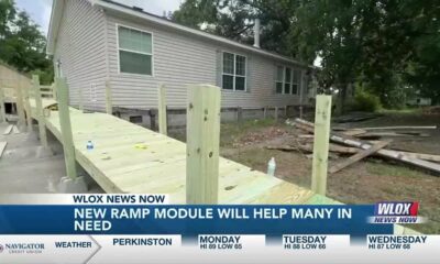
Nonprofit installs faster handicap ramps for veterans and others in need

Remembering Alexis Herman: Longtime friend shares memories

Dogwood Festival resumes after reports of gunfire Saturday night

Fiesta de los Niños celebrates STEM learning and video games at Fiesta 2025

Search Continues for Driver Who Ran Over Two Teenage Girls and Drove Off Without Helping

Starting Monday, Cy Fair ISD restarting more than a dozen school bus routes that were cut

Economic uncertainty could benefit Atlanta's housing market | FOX 5 News

Hundreds gather for Harbor House Paws for Peace Walk & Run in Orlando

Derrick Simmons: Monday’s Confederate Memorial Day recognition is awful for Mississippians

New Amazon dock operations facility to bring 1,000 jobs to Marshall County

Missouri lawmakers on the cusp of legalizing housing discrimination

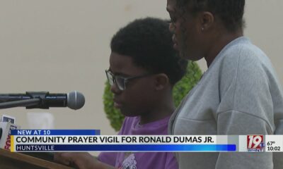
Prayer Vigil Held for Ronald Dumas Jr., Family Continues to Pray for His Return | April 21, 2025 | N

Trump touts manufacturing while undercutting state efforts to help factories

Meteorologist Chita Craft is tracking a Severe Thunderstorm Warning that's in effect now

Federal report due on Lumbee Tribe of North Carolina’s path to recognition as a tribal nation

Taking video of military bases using drones could be outlawed | Virginia

Struggling water, sewer systems impose ‘astronomic’ rate hikes

Oklahoma Treasurer’s Office Faces Scrutiny Over Use of Signal in Anti-ESG Coordination

Bay St. Louis priest reflects on Pope Francis’ legacy
Ticket deadline approaches for St. Jude Dream Home Giveaway
Nonprofit installs faster handicap ramps for veterans and others in need
Remembering Alexis Herman: Longtime friend shares memories
Dogwood Festival resumes after reports of gunfire Saturday night
Fiesta de los Niños celebrates STEM learning and video games at Fiesta 2025
Search Continues for Driver Who Ran Over Two Teenage Girls and Drove Off Without Helping
Starting Monday, Cy Fair ISD restarting more than a dozen school bus routes that were cut
Economic uncertainty could benefit Atlanta's housing market | FOX 5 News

TIMELINE: Storm chances return for parts of Oklahoma on Sunday, in coming days

South Florida 11 p.m. Weather Forecast 4/26/2025
-

 SuperTalk FM6 days ago
New Amazon dock operations facility to bring 1,000 jobs to Marshall County
-
News from the South - Missouri News Feed2 days ago
Missouri lawmakers on the cusp of legalizing housing discrimination
-
News from the South - Alabama News Feed6 days ago
Prayer Vigil Held for Ronald Dumas Jr., Family Continues to Pray for His Return | April 21, 2025 | N
-
News from the South - Florida News Feed6 days ago
Trump touts manufacturing while undercutting state efforts to help factories
-
News from the South - Texas News Feed7 days ago
Meteorologist Chita Craft is tracking a Severe Thunderstorm Warning that's in effect now
-
News from the South - Florida News Feed6 days ago
Federal report due on Lumbee Tribe of North Carolina’s path to recognition as a tribal nation
-
 News from the South - Virginia News Feed7 days ago
Taking video of military bases using drones could be outlawed | Virginia
-
Mississippi Today4 days ago
Struggling water, sewer systems impose ‘astronomic’ rate hikes