News from the South - West Virginia News Feed
Showers and Storms Lingering; Rollercoaster Week Ahead: Christian’s Latest Forecast
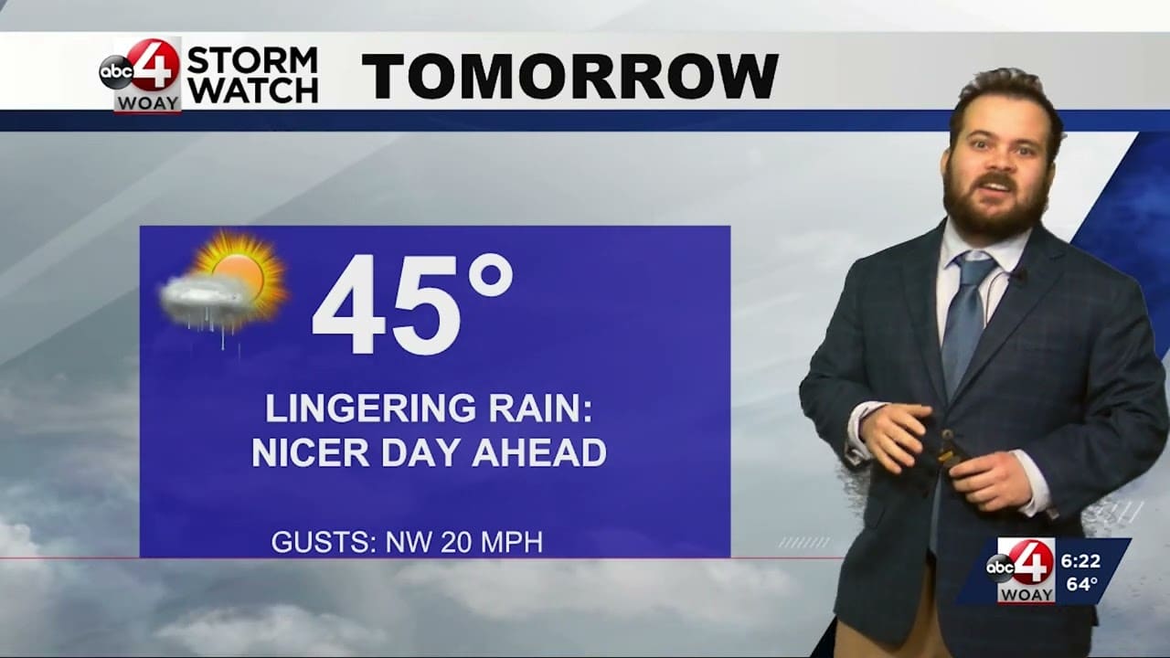
SUMMARY: Christian Botler’s latest forecast predicts lingering showers and storms, with temperatures dropping into the 40s overnight. After some rain and gusty winds, Monday will be cool with a high of 45°F. The week will see fluctuating temperatures, reaching 75°F by Wednesday before dipping back into the 40s on Thursday. Friday could bring lingering snow showers, followed by rain on Saturday. Sunday will offer a pleasant end to the week with a high of 56°F. The 6-10 day precipitation outlook suggests above-average rainfall, continuing the trend from previous months. Be cautious of fog and visibility issues during the morning commute.

FOLLOW US ON FACEBOOK AND TWITTER:
https://facebook.com/WOAYNewsWatch
https://twitter.com/WOAYNewsWatch


News from the South - West Virginia News Feed
Morrisey’s line-item budget vetoes slash funds for vulnerable children during foster care crisis
by Amelia Ferrell Knisely, West Virginia Watch
April 18, 2025
Gov. Patrick Morrisey signed the budget bill Thursday night, but not before slashing millions of dollars in funding through his line-item veto power. The Republican governor’s cuts were wide sweeping across state programs, and services for vulnerable children were among those surprisingly hit.
“When I took office, I inherited a $400 million structural budget gap in the upcoming fiscal year, which would grow to nearly $600 million in the years ahead if it was not immediately addressed,” Morrisey said in a statement released by his office. “The fiscally conservative budget I signed tonight makes progress tackling structural gaps and begins to place us on a pathway toward financial stability in the future.”
The 29 separate line-item vetoes included slashes in funding for roads, school safety and tourism projects. There were also millions of dollars in cuts to programs that serve foster kids, families impacted by substance abuse and sick children.
Morrisey cut $250,000 in funding for Lily’s Place, a nonprofit organization in Cabell County that provides treatment for newborns with neonatal abstinence syndrome and support for families dealing with substance use disorder. West Virginia has the highest rate nationally of infants born with neonatal abstinence syndrome amid the state’s ongoing substance abuse crisis.
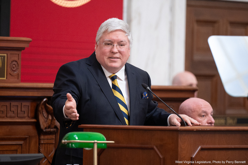
House Finance Chairman Vernon Criss, R-Wood, called it “the most insulting” of Morrisey’s line-item vetoes.
“This one should be right at the top — to be able to take newborns that are drug-afflicted and be able to help them,” Criss said. “[It] seems to have a very high success rate of helping newborns getting off the drug situation.”
Morrisey also decreased funding for the Ronald McDonald House in Morgantown and In-Home Family Education, a parent and child support program in West Virginia.
“It’s almost like you’re picking on kids who can’t speak up for themselves,” said House Minority Leader Sean Hornbuckle, D-Cabell.
The legislative session adjourned with little action on the state’s abundant foster care issues despite bills introduced to address a myriad of problems, including too many foster children living in hotels.
Lawmakers wanted to give $1.1 million in state funding to West Virginia’s Court Appointed Special Advocates, or CASA, a program that helps foster children in the court system.
Morrisey cut 75% of that funding in his line-item veto. His office did not respond to an email from West Virginia Watch seeking information about the funding decrease. In his veto message, the governor said the program relies on grants and could seek additional grant funding.
Shanna Gray, executive director of West Virginia CASA, said she was grateful to the Legislature for creating a dedicated line item for the program.
“We could not be more appreciative of our state lawmakers for prioritizing support for children in foster care,” she said. “Albeit significantly reduced, the governor‘s final allocation of $300,000 establishes a crucial foundation of state support. We remain optimistic about this initial investment and thankful for the state’s recognition of CASA’s essential role in ensuring children’s best interests are represented and heard.”
In total, Morrisey cut $800,000 in foster care funding.
“The fear is that we’ve got programs out there right now that we do not know if they’ll be able to continue because the federal dollars are going to dry up,” Criss said. “[Morrisey] needs to be able to take a very hard look at all the programs.”
In a news release on Friday, the West Virginia Democratic Party called on the governor to “reconsider these harmful decisions and focus state resources on supporting vulnerable citizens and vital community programs.”
Disagreement among GOP supermajority about budget
The Republican-led House and Senate passed their $5.3 billion general revenue budget bill last week.
Morrisey’s line-item veto messages used similar language often, saying, “it is imperative that a cautious and prudent approach be taken” while citing concerns about future uncertainties, like the federal stock market fluctuations and federal uncertainty. He also said that there are “ongoing budget challenges.”
The spending vetoes also included $500,000 reduction to Mountwood Park in Wood County for Jeep trails, and a $187,000 reduction to the more than $11 million allocation to the state Veterans Nursing home, and a $250,000 cut for a nursing education program.
“He decided nursing programs are not where he wants to spend money,” Criss said.
There was a $25 million reduction to the State Road Fund; Criss said that funding cuts may damage the state Division of Highways’ ability to draw down federal funds for projects.
Morrisey eliminated $250,000 allocated for the West Virginia University College of Law but did not touch the $1.5 million lawmakers gave the university to build a civics learning center overseen by a political appointee. Lawmakers passed a bill mandating the center, but it hasn’t yet been signed by the governor.
He slashed more than $110 million approved in three surplus funds, which included the funding for Lily’s Place. Morrisey said those funds may be needed for anticipated gaps in Medicaid, Public Employees Insurance Agency and federal changes.
Morrisey is a staunch supporter of President Donald Trump; Hornbuckle said the governor’s decision to slash state spending because concerns about Medicaid and federal changes showed, “Even the governor doesn’t believe his good friend is going to be able to help West Virginians.”
“We might have to fill back in dollars to Medicaid or PEIA,” Hornbuckle continued. “People need to be really paying attention to what’s going on there, and he doesn’t trust the Trump administration.”
Hornbuckle added that Morrisey’s line-item vetoes showed disagreement among the state’s GOP-supermajority in power.
Criss continues to refute Morrisey’s projected $400 million structural deficit.
“I am the last finance chairman still in place from the previous administration, I take that a personal cut,” he said. “[Morrisey] doesn’t understand how we have been budgeting and doing the budget process for the last seven years when we’ve tried to keep our ‘operating portion’ of our budget.” The House wanted the state to have surplus money in the back of the budget that could be used for one-time projects.
Senate Finance Chairman Jason Barrett, R-Berkeley, wasn’t available for comment.
Funds slashed for safe schools, educational programs
Morrisey’s line-item vetoes included several education-related projects, including funding decreasing to the Mountain State Digital Literacy Program, a math education program and computer science education. In a veto of $200,000 in funding for Safe Schools, Morrisey said it is, “imperative that we limit new spending.”
West Virginia’s public schools can’t afford to implement millions of dollars in safety upgrades, including secure front entries and weapon detection systems. There are more than $200 million in school safety requests in need of funding.
“How can we in good faith cut money to safe schools and that is something that goes to all of our public education when we are pumping millions of dollars into the Hope voucher program?” Hornbuckle said.
The budget passed by the Republican-led Legislature opted to put away about $33.6 million from general revenue to the state Personal Income Tax Reserve Fund. That money, Criss said, can be allocated by the Legislature at any time. The fund has more than $500 million in it, drawing frustration from Del. Kayla Young, D-Kanawha, during budget debate since other programs had gone unfunded.
The budget didn’t include $100,000 for clean drinking water in Wyoming County. Funding was cut for the state’s Jobs and Hope Program.
Hornbuckle voted against the budget when it passed the House, citing concerns about a lack of funding for child care.
“I didn’t think it had a lot of fiscal logic and appropriate the dollars that we do have to public education or child care,” he said. “I’m also confused why we went further down the hole right now in making the current cuts that we did.”
In a statement on Thursday, Morrisey said that “much work remains in the next fiscal year to address budget shortfalls.”
“ … I applaud the Legislature for sending me a budget that closely resembles my original proposal and begins to address long term issues while funding West Virginia priorities,” he said.
YOU MAKE OUR WORK POSSIBLE.
West Virginia Watch is part of States Newsroom, a nonprofit news network supported by grants and a coalition of donors as a 501c(3) public charity. West Virginia Watch maintains editorial independence. Contact Editor Leann Ray for questions: info@westvirginiawatch.com.
The post Morrisey’s line-item budget vetoes slash funds for vulnerable children during foster care crisis appeared first on westvirginiawatch.com
News from the South - West Virginia News Feed
Federal judge finds probable cause for contempt against Trump administration in deportation case

SUMMARY: A federal judge found probable cause for contempt against the Trump administration over the deportation of Kilar Armando Abrego Garcia, despite a Supreme Court ruling ordering his return. The Department of Justice called it an “administrative error,” while Attorney General Pam Bondi insisted he would not be returned. Senator Chris Van Hollen criticized the administration, demanding accountability for violating due process. A New York Times investigation revealed most deported migrants had no significant criminal background, fueling concerns about potential overreach by the Trump administration. Democrats warn that such actions threaten democratic principles.

A federal judge has determined there is probable cause to hold Trump administration officials in criminal contempt for defying orders to halt deportations under the Alien Enemies Act.
#federalgovernment #federaljudge #nationalnews #trumpadministration #kilmarabregogarcia #immigration #immigrants #breakingnews
_________________________________________
For the latest local and national news, visit our website: https://wchstv.com/
Sign up for our newsletter: https://wchstv.com/sign-up
Follow WCHS-TV on social media:
Facebook: https://www.facebook.com/eyewitnessnewscharleston/
Twitter: https://twitter.com/wchs8fox11
Instagram: https://www.instagram.com/wchs8fox11/
News from the South - West Virginia News Feed
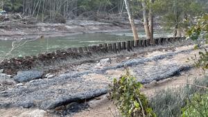
West Virginia’s Gauley River among the nation’s most endangered, conservation organization says

by Lori Kersey, West Virginia Watch
April 16, 2025
West Virginia’s Gauley River has been named to a conservation organization’s list of the most endangered rivers in the country this year.
The river is 10th on the list of America’s Most Endangered Rivers for 2025. The river is threatened by coal mining pollution in one of its tributaries, the Cherry River, according to the organization.
Each year, American Rivers sets the list of rivers that face a major decision that the public can influence. The list is based on the significance of the river to people and wildlife, and the magnitude of the threat.
The West Virginia Highlands Conservancy and Appalachian Voices is suing the South Fork Coal Company, which operates more than 3,000 acres of surface mines in Greenbrier and Pocahontas counties outside the Monongahela National Forest, over alleged violations of the Clean Water Act and Surface Mining Control and Reclamation Act.
The mines have violated water pollution standards at least 80 documented times since 2019, releasing sediment and toxic heavy metals into the river, according to a news release.
The groups have challenged the U.S. Forest Service decision to grant the company access to use a national forest road as a haul road without complying with environmental protection laws. The company was first granted access to the road in 2013 based on an application that falsely claimed it did not cross into the forest, said Olivia Miller, program director for the West Virginia Highlands Conservancy. The access was renewed in 2018 and 2023.
The company has been permitted to operate the Rocky Run Surface Mine, the mine at the center of the lawsuits over pollution, since 2021.
The road was temporarily shut down, but reopened after the company appealed to the Department of Interior, Miller said.
The environmental groups’ lawsuits have been stayed after the coal company filed for chapter 11 bankruptcy in February.
“We’re waiting to see what happens with the bankruptcy proceedings. So this could be tied up in court for years, and meanwhile, they are still hauling coal,” Miller said.
The Office of Surface Mining, Reclamation and and Enforcement (OSMRE) has a public comment period underway now about the coal company’s request for a valid existing rights determination to continue using the road. Mining activity in the national forest is prohibited, exempt for a few exemptions.
“For four years, this company has illegally operated within the Monongahela National Forest,” Willie Dodson, coal impacts program manager at Appalachian Voices said in a news release. “Now, having just declared bankruptcy, South Fork Coal is asking regulators to retroactively validate this activity. It’s unacceptable. If they get away with it, I shudder to think what the next encroachment by the coal industry into our public land will be. Are they going to strip Spruce Knob? Are they going to put a sludge dam at Cranberry Glades? This is the time to draw a line in the sand.”
Miller said the river being added to the endangered list will help alert policy makers and the public of the river’s plight.
“The Gauley’s listing specifically will hopefully draw national attention to ongoing problems that we’re seeing with this company and encourage the public and policymakers to step up before any more irreversible harm occurs in this sensitive area,” Miller said.
“We are asking OSMRE to deny the after-the-fact request that the company can continue using this road,” Miller said. “So right now, we need as much public comment as possible to pressure the OSMRE to deny their valid existing rights request.”
A representative of South Fork Coal Company could not immediately be reached for comment.
The Gauley River draws tens of thousands of white water rafters each year for its world class rapids. The river and its tributaries are also popular fishing destinations. Miller said pollution puts the river’s recreation opportunities at risk.
“The outcome of this valid existing rights determination will reverberate far beyond West Virginia, and I think will really set a precedent for better or for worse on mining and public lands,” Miller said. “And I really don’t believe that the people of West Virginia want to see the Monongahela National Forest impacted or mined. As somebody who grew up in the Mon in Tucker County, that would be just completely devastating and earth shattering for me to see happen in my lifetime.
“So now is the time for people to come together and protect our outdoor recreation economy and activities like rafting, fishing and hiking, hunting that people from West Virginia love, and these are activities that thrive on clean, healthy ecosystems,” Miller said.
The Gauley River listing comes days after President Donald Trump signed a series of executive orders meant to bolster the nation’s struggling coal industry. The orders allow some older coal-fired power plants set for retirement to keep operating and directs federal agencies to lift barriers to coal mining and prioritize coal leasing on U.S. lands.
“Coal is the dirtiest of fossil fuels,” Miller said. “Even though most of our state leaders would like to ignore climate change, we cannot ignore it any longer and this push to ‘bring back coal’ is only going to cause more pain and suffering for people in West Virginia and across the world,” she said. “And I think the recent executive orders really exemplifies the tension between efforts to bolster domestic coal production again and the need to protect public lands and water resources.”
GET THE MORNING HEADLINES.
West Virginia Watch is part of States Newsroom, a nonprofit news network supported by grants and a coalition of donors as a 501c(3) public charity. West Virginia Watch maintains editorial independence. Contact Editor Leann Ray for questions: info@westvirginiawatch.com.
The post West Virginia’s Gauley River among the nation’s most endangered, conservation organization says appeared first on westvirginiawatch.com

Op-Ed: Colleges shouldn’t need remedial algebra classes: Five K-8 policy solutions to address math proficiency | Maryland

Savannah State University police talk campus safety

Vicente Fernandez and Freddy Fender join National Recording Registry

DreKo Music Productions LLC Ribbon Cutting

Scientists found a potential sign of life on a distant planet – an astronomer explains why many are still skeptical

Easter events happening across the coast

Court restores status of 3 international students in Texas

Trump administration revokes Murray State international student’s visa

Morrisey’s line-item budget vetoes slash funds for vulnerable children during foster care crisis

Q&A with University of Louisiana System President Rick Gallot on higher education

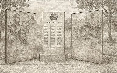
On this day in 1873, La. courthouse scene of racial carnage

AG Fitch and Children’s Advocacy Centers of Mississippi Announce Statewide Protocol for Child Abuse Response

Lawmakers used to fail passing a budget over policy disagreement. This year, they failed over childish bickering.

Southern Miss Professor Inducted into U.S. Hydrographer Hall of Fame

Foley man wins Race to the Finish as Kyle Larson gets first win of 2025 Xfinity Series at Bristol

Helene: Renewed focus on health of North Carolina streams | North Carolina

Federal appeals court upholds ruling against Alabama panhandling laws

Food Chain Drama | Our Mississippi Home

Bellingrath Gardens previews its first Chinese Lantern Festival

Severe weather has come and gone for Central Florida, but the rain went with it
Vicente Fernandez and Freddy Fender join National Recording Registry

Rome Ramirez: Solo Debut

Expert Talk – Senior Medicare Patrol (Telehealth Fraud)

Panoply 2025’s Musical Guests | April 18, 2025 | News 19 at 9 a.m.

Living with Parkinson's: The emotional, physical toll on caretakers

Be Our Guest to Cocina Latina with traditional Mexican dishes!

Dream Home Giveaway supports St. Jude families

Magic of Storytelling | Thumper and the Egg

Texas Students Prepare For STAAR Testing Next Week

GMSA+ : Apr 18, 2025
-

 Mississippi Today6 days ago
On this day in 1873, La. courthouse scene of racial carnage
-
 Local News6 days ago
AG Fitch and Children’s Advocacy Centers of Mississippi Announce Statewide Protocol for Child Abuse Response
-
Mississippi Today6 days ago
Lawmakers used to fail passing a budget over policy disagreement. This year, they failed over childish bickering.
-
Local News6 days ago
Southern Miss Professor Inducted into U.S. Hydrographer Hall of Fame
-
News from the South - Alabama News Feed4 days ago
Foley man wins Race to the Finish as Kyle Larson gets first win of 2025 Xfinity Series at Bristol
-
News from the South - Alabama News Feed4 days ago
Federal appeals court upholds ruling against Alabama panhandling laws
-
Our Mississippi Home7 days ago
Food Chain Drama | Our Mississippi Home
-
 News from the South - North Carolina News Feed7 days ago
Helene: Renewed focus on health of North Carolina streams | North Carolina