News from the South - Louisiana News Feed
Remembering Hurricane Katrina: August 28, 2005
SUMMARY: As Hurricane Katrina approaches, the first bands of the storm have reached the city, with wind and rain intensifying. A curfew is in effect in Harrison County, restricting movement. In New Orleans, the Superdome serves as a refuge for those without shelter. WWL’s staff is split, with half remaining in the city and others relocating to Baton Rouge to continue coverage. The threat escalates as Katrina is upgraded to a category five hurricane, heightening concerns about its potential impact. The situation is dire, and preparations are in place to report on the unfolding disaster.


News from the South - Louisiana News Feed
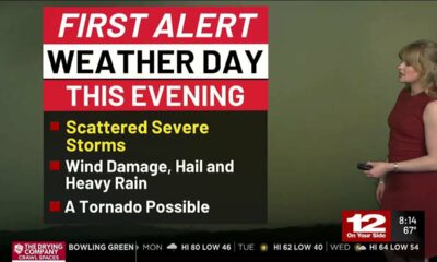
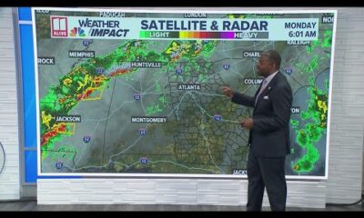
New Orleans Weather Impact: Strong storms are set to arrive early Monday
SUMMARY: New Orleans is preparing for strong storms on Monday, with the potential for severe weather as a cold front approaches. The day is expected to be the only active weather day this week, with rain chances peaking at around 60% from morning to early afternoon. Temperatures will be in the lower 80s, following a record high of 86 degrees. After Monday, the weather is predicted to be warm and dry, with highs rising close to 90 by the week’s end. Although the week will start warm and humid, a chance of rain may return next weekend.

Meteorologist Alexandra Cranford says most rain will happen from morning to early afternoon Monday.
News from the South - Louisiana News Feed
Lauren Betts and UCLA reach first Final Four of women’s NCAA Tournament, beating LSU 72-65
SUMMARY: UCLA defeated LSU 72-65 to reach its first women’s NCAA Final Four, with Lauren Betts scoring 17 points, seven rebounds, and six blocks despite sitting out the second quarter due to foul trouble. Gabriela Jaquez added 18 points and Timea Gardiner contributed 15. Betts credited her teammates for holding the lead while she was sidelined. LSU’s Flau’Jae Johnson led with 28 points, but UCLA maintained control in the final quarter, with Jaquez’s three-pointer sealing the win. The Bruins will face the winner of Southern California vs. UConn in the Final Four in Tampa.
The post Lauren Betts and UCLA reach first Final Four of women's NCAA Tournament, beating LSU 72-65 appeared first on wgno.com
News from the South - Louisiana News Feed
As Sundance leaves, Utah Gov. Cox allows first-in-the-nation flag ban to become law without his pen
by Katie McKellar, Louisiana Illuminator
March 30, 2025
SALT LAKE CITY — Saying Utahns are “tired of culture war bills that don’t solve the problems they intend to fix,” Utah Gov. Spencer Cox will allow a bill aimed at banning many flags — including pride or LGBTQ+ flags — from schools and all government buildings to become law without his signature.
Cox explained his reasoning in a letter to legislative leaders issued with just over an hour to spare before his midnight deadline Thursday to sign or veto bills passed by the 2025 Utah Legislature.
“HB77 has been one of the most divisive bills of the session, and I am deeply disappointed that it did not land in a better place,” wrote Cox, who also explained he agreed with the intent behind the legislation. “My understanding is that there was a deal on a compromise that would have removed problematic portions of the bill while retaining others that would support political neutrality in the classroom. Sadly the sponsors did not move that deal forward.”
Supporters of HB77, sponsored by Rep. Trevor Lee, R-Layton, argued it was meant to promote “political neutrality” in government spaces. But critics argued a broad ban that extended to all government properties would invite free speech litigation while also leaving some Utahns, especially the LGBTQ+ community, feeling unwelcome and erased.
GET THE MORNING HEADLINES.
Now slated to take effect on May 7, HB77 will ban almost all flags from being displayed on or in public buildings, except for flags explicitly allowed in a prescriptive list included in the bill, such as the U.S. flag, the state flag, military flags, Olympic flags, college or university flags, or others. Pride flags or other LGBTQ+ flags — which Utah lawmakers in recent years have repeatedly tried to bar from schools in various ways — would be prohibited.
It’s slated to make Utah the first state in the nation to enact such sweeping flag restrictions in government-owned buildings. The Idaho Legislature recently passed a similar bill, HB41, which Gov. Brad Little signed last week, but that legislation won’t take effect until July 1 and it only applies to schools. Idaho lawmakers are also advancing a separate bill to restrict government entities from displaying certain types of flags.
Utah’s largest LGBTQ+ rights group, Equality Utah, had negotiated with lawmakers on the bill, which originally focused the flag ban on school classrooms. However, in a House committee last month, Lee changed the legislation to broaden the flag ban to all government property, leading Equality Utah to oppose the bill even though it was prepared to take a “neutral” position on its earlier version.
Cox faced numerous calls to veto HB77 from advocacy groups including Equality Utah and the American Civil Liberties Union of Utah, as well as from Salt Lake City Mayor Erin Mendenhall, whose city hosts the annual Utah Pride Festival. He could have vetoed the bill — but he indicated in his letter that it would likely just be overridden by the GOP-supermajority Utah Legislature. Instead, he’s urging lawmakers to work to fix it.
“I continue to have serious concerns with this bill,” Cox said. “However, because a veto would be overridden, I have decided to allow the bill to go into law without my signature, and urge lawmakers to consider commonsense solutions that address the bill’s numerous flaws.”
Cox encouraged lawmakers to consider allowing the Utah State Board of Education to “go further in ensuring the political neutrality of our classrooms, while also considering repealing the local government piece of this legislation and allowing elected representatives to answer to their own constituents.”
“If you are willing to pursue this kind of solution, you will have an open door in the executive branch,” Cox wrote.
Cox’s comments on the flag ban came after the bill cast final-hour drama over Utah’s multimillion-dollar bid to entice the Sundance Film Festival to stay, with some saying it could impact Utah’s chances.
Earlier Thursday, festival organizers announced they’d opted to move the event to Colorado to help the festival grow. By the time they’d reached their decision, Cox had not yet acted on HB77, but a veto was looking unlikely.
While Cox told reporters last week Sundance organizers had told state leaders “very clearly that political issues have nothing to do with the decision,” others, including Salt Lake City Mayor Erin Mendenhall, worried that HB77 could indeed be “harmful to our effort to retain Sundance.”
In the end, Utah lost its bid. Cox — who earlier Thursday called Sundance’s decision a “mistake” — also included a note in his letter that he’ll be calling a special session to address, among other issues, what the Legislature should instead do with the $3.5 million it had set aside as part of Utah’s bid to keep Sundance.
“Let’s reappropriate that money to efforts in Utah to create a new festival and a world-class film economy right here in our state,” he said.
Cox says he agrees with ‘underlying intent’ but HB77 has flaws
Cox, in his letter, dove deeper into why he had misgivings with HB77 but said he agreed with the “underlying intent” of the bill.
“I deeply believe that our classrooms need to be a place where everyone feels welcome — free from the politics that are fracturing our country,” Cox wrote. “Parents are rightly upset when they bring their kids to publicly funded schools and see culture-war symbols in a place that should be apolitical. In an attempt to make some kids feel more welcome, other kids feel less welcome.”
Cox also said he appreciated that the bill is “neutral on the types of flags in question,” while adding that “I find it strange that no headline reads ‘MAGA flags banned from classrooms.’”
“I agree with the underlying intent of those legislators who supported this bill in an attempt to bring political neutrality to the classroom,” he said, though he added, “Unfortunately, this bill does not do that.”
He said because it’s aimed at only flags, “there is little preventing countless other displays — posters, signs, drawings, furniture — from entering the classroom.”
“To those legislators who supported this bill, I’m sure it will not fix what you are trying to fix,” Cox said.
He noted that many schools have already enacted their own “political neutrality” policies in classrooms, and he argued “we have a better place” to make regulations: the Utah State Board of Education. While he said the board has already set expectations for political neutrality in teacher code of conduct, “I believe more needs to be done by USBE to provide direction in this regard.”
“I have asked the Board of Education to continue their work to find ways to make our classrooms both more politically neutral and more welcoming to every student to exercise their own individual freedom of expression,” Cox said. “The idea that kids can only feel welcome in a school if a teacher puts up a rainbow flag is just wrong. Let’s do everything possible to make our classrooms one of the last remaining politically neutral places in our state.”
Cox says bill goes ‘too far’
The governor added that the flag ban “goes too far” by extending the ban to local governments.
“While I think it’s wrong for city and county officials to fly divisive flags, I believe that election have consequences and the best way to stop that behavior is to elect people who believe differently,” Cox said. “All this bill does is add more fuel to the fire, and I suspect it will only ratchet up the creative use of political symbolism.”
Ultimately, Cox urged legislators to focus on solutions rather than legislation that deepens divides.
“As tired as Utahns are of politically divisive symbols, I think they are also tired of culture war bills that don’t solve the problems they intend to fix,” he said.
The governor urged lawmakers to work with the LGBTQ+ community, as they have in the past, to find common ground.
“Utah has always had a reputation of trying to find a way to work together and solve issues between sides that have strongly-held, opposing points of view,” Cox said. “There are so many examples of the LGBTQ community and the conservative community coming together to find helpful and hopeful compromise. I hope we can retain this as our model and North Star.”
The governor also shared a message directly to LGBTQ+ Utahns, acknowledging that “recent legislation has been difficult.”
“Politics can be a bit of a blood sport at times and I know we have had our disagreements,” he said. “I want you to know that I love and appreciate you and I am grateful that you are part of our state. I know these words may ring hollow to many of you, but please know that I mean them sincerely.”
YOU MAKE OUR WORK POSSIBLE.
This report was first published by the Utah News Dispatch, part of the States Newsroom nonprofit news network. It’s supported by grants and a coalition of donors as a 501c(3) public charity. Utah News Dispatch maintains editorial independence. Contact Editor McKenzie Romero for questions: info@utahnewsdispatch.com.
Louisiana Illuminator is part of States Newsroom, a nonprofit news network supported by grants and a coalition of donors as a 501c(3) public charity. Louisiana Illuminator maintains editorial independence. Contact Editor Greg LaRose for questions: info@lailluminator.com.
This report was first published by the Utah News Dispatch, part of the States Newsroom nonprofit news network. It’s supported by grants and a coalition of donors as a 501c(3) public charity. Utah News Dispatch maintains editorial independence. Contact Editor McKenzie Romero for questions: info@utahnewsdispatch.com.
The post As Sundance leaves, Utah Gov. Cox allows first-in-the-nation flag ban to become law without his pen appeared first on lailluminator.com

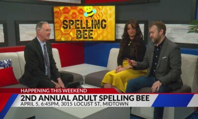
2nd Annual Adult Spelling Bee

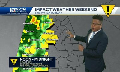
First Alert Weather Day Monday: Scattered strong to severe storms

‘Egg beaters,’ ‘Bob Evans’ liquid eggs recalled; may contain cleaning solution: USDA

Local organization to host career fair, mock interview workshops in April

Everyday Economics: Stock market down, stagflation concerns, fragile incomes | National

Woolmarket roundabouts completion pushed back again

Bill regulating video gambling faces hazy future with weeks left in Missouri’s legislative session

Georgia weather outlook Monday, March 31 | Strong storms expected

Arkansas town hit hard by tornado making progress

WTOK Weather 3/30/25 – Zack Rogers

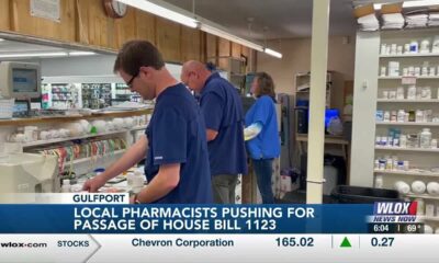
Local pharmacists advocating for passage of bill limiting control of pharmacy benefit managers

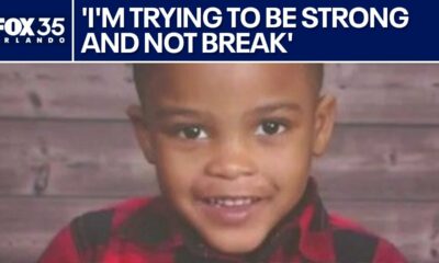
Family mourns death of 10-year-old Xavier Williams

LIVE: SpaceX NROL-69 mission launch

1 Dead, Officer and Bystander Hurt in Shootout | March 25, 2025 | News 19 at 9 p.m.

Report: Proposed Medicaid, SNAP cuts would cost Arkansas thousands of jobs, $1B in GDP

Classmates remember college student hit by car, killed near NC State

Severe storms will impact Alabama this weekend. Damaging winds, hail, and a tornado threat are al…

University of Alabama student detained by ICE moved to Louisiana

Rep. Tom Cole Says DOGE Is ‘Pretty Responsive’ to His Concerns

Va. community colleges end diversity, equity and inclusion practices
2nd Annual Adult Spelling Bee
First Alert Weather Day Monday: Scattered strong to severe storms
Local organization to host career fair, mock interview workshops in April
Woolmarket roundabouts completion pushed back again
Georgia weather outlook Monday, March 31 | Strong storms expected
WTOK Weather 3/30/25 – Zack Rogers

Thunderstorms drench areas south of St. Louis

New Orleans Weather Impact: Strong storms are set to arrive early Monday

St. Louis metro area expecting another round of severe weather Wednesday

Severe Weather Overnight; Rainy Week Ahead: Christian’s Latest Forecast
-

 Local News Video7 days ago
Local pharmacists advocating for passage of bill limiting control of pharmacy benefit managers
-
News from the South - Florida News Feed5 days ago
Family mourns death of 10-year-old Xavier Williams
-
News from the South - Florida News Feed7 days ago
LIVE: SpaceX NROL-69 mission launch
-
News from the South - Alabama News Feed6 days ago
1 Dead, Officer and Bystander Hurt in Shootout | March 25, 2025 | News 19 at 9 p.m.
-
News from the South - Arkansas News Feed6 days ago
Report: Proposed Medicaid, SNAP cuts would cost Arkansas thousands of jobs, $1B in GDP
-
News from the South - North Carolina News Feed6 days ago
Classmates remember college student hit by car, killed near NC State
-
News from the South - Alabama News Feed4 days ago
Severe storms will impact Alabama this weekend. Damaging winds, hail, and a tornado threat are al…
-
 News from the South - Alabama News Feed3 days ago
University of Alabama student detained by ICE moved to Louisiana