News from the South - Alabama News Feed
Mobile Greek Fest 2024 — know before you go
SUMMARY: The Mobile Greek Fest kicked off today, marking the start of a beloved four-day celebration of Greek culture and cuisine, ongoing since 1962. WKRG’s Christina J Harris explores Midtown, highlighting family activities and delicious food, notably the Greek dessert baklava and lucamades, a fluffy fried treat similar to donuts. Nick SES, from the Annunciation Greek Orthodox Church, has been making lucamades with his grandmother’s recipe for over 40 years. The festival also features Greek bakery items, gyros, and wine. Greek Fest has become a popular annual event that promotes community spirit and joy.

Mobile’s 62nd Annual Greek Fest kicked off on Thursday at the Annunciation Greek Orthodox Church.
FULL STORY: https://trib.al/6Kaka2m
News from the South - Alabama News Feed
2nd Annual Taste of Sheffield on April 3 | April 1, 2025 | News 19 at 9 a.m.
SUMMARY: The 2nd Annual Taste of Sheffield, hosted by Sheffield City Schools, takes place Thursday, April 3, and promises to be bigger than its inaugural event. The tasting fair features 15 local restaurants, up from ten last year, offering generous samples of their most popular dishes. Attendees purchase tickets based on how many vendors they wish to try and enjoy a wide range of cuisines, including American, Thai, Mexican, Italian, and more. With everything from wings to barbecue and desserts, the event guarantees no one leaves hungry. It’s a fun, community-focused celebration of Sheffield’s vibrant culinary scene.

You are invited to the 2nd Annual Taste of Sheffield event on Thursday, April 3, 5:30-7 p.m. on the terrace behind L.E. Willson …
News from the South - Alabama News Feed
'I think everybody's concerned': Mercedes-Benz plant eyeing impact of imported vehicle tariffs
SUMMARY: The Mercedes-Benz plant in Tuscaloosa, Alabama, is closely monitoring the upcoming 25% tariffs on imported vehicles, which President Trump claims will boost U.S. manufacturing despite potentially raising car prices. The plant, a significant part of the state’s economy with over 6,000 employees and a $7 billion investment, relies heavily on international trade. Senator Tommy Tuberville acknowledged concerns among constituents about the tariffs affecting auto manufacturing, but expressed hope that Trump’s forthcoming press conference would clarify the administration’s strategy and soothe economic anxieties. Updates from other local auto manufacturers are expected soon.

‘I think everybody’s concerned’: Mercedes-Benz plant eyeing impact of imported vehicle tariffs
Subscribe to WVTM on YouTube now for more: https://bit.ly/2jvAaUD
Get more Birmingham news: http://www.wvtm13.com
Like us: https://www.facebook.com/WVTM13/
Follow us: https://twitter.com/WVTM13
Instagram: https://www.instagram.com/wvtm13/
News from the South - Alabama News Feed
Democrats ask congressional watchdog agency to probe Trump’s funding freezes
by Jennifer Shutt, Alabama Reflector
March 31, 2025
WASHINGTON — Top Democrats in Congress are asking the Government Accountability Office to open an investigation into whether the Trump administration violated federal law by freezing funding for several programs.
Pennsylvania Rep. Brendan Boyle and Oregon Sen. Jeff Merkley, ranking members on the House and Senate Budget committees, wrote in a two-page letter sent Monday to the government watchdog organization that certain actions appear to have violated the Impoundment Control Act.
“Unilaterally impounding funds is illegal, and Donald Trump and Russ Vought are trying to gut the federal government piece by piece,” Merkley wrote in a statement accompanying the letter. “GAO must get to the bottom of this and reiterate to the administration that Congress has the power of the purse, not Trump and Vought.”
The Senate voted along party lines earlier this year to confirm Vought as director of the Office of Management and Budget, which has wide-reaching authority over decisions within the executive branch
A Government Accountability Office spokesperson told States Newsroom the agency is working through its process to determine whether it will launch an investigation based on the letter.
GAO, the spokesperson said, also has ongoing work related to the ICA.
OMB authority
Boyle wrote in a statement that the Constitution gives Congress the authority to determine when and where the federal government spends money.
“The administration’s withholding of critical investments harms American communities that rely on these funds for jobs, economic stability, and essential infrastructure,” Boyle wrote. “Robust congressional oversight, alongside litigation, is vital to protecting the interests of the American people.”
The Impoundment Control Act, enacted in the 1970s, bars presidents from not spending the money that Congress has appropriated. Vought has said repeatedly he believes the law is unconstitutional and that presidents have this authority.
Several lawsuits have been filed over the Trump administration opting not to spend federal money, some of which have blocked the actions from taking effect while the cases proceed through the federal courts.
The Boyle-Merkley letter alleges the Trump administration has run afoul of the law on several occasions, including on his first day in office when he ordered a pause on foreign development assistance as well as funding in the Inflation Reduction Act and the bipartisan infrastructure law.
The two ask GAO to also look into the Trump administration’s decision to halt military aid to Ukraine for about a week in March, writing they are “concerned this pause may have been an illegal impoundment with negative foreign policy and national security implications.”
“The Constitution grants the President no unilateral authority to withhold funds from obligation,” Boyle and Merkley wrote in the letter. “Instead, Congress has vested the President with strictly circumscribed authority to impound or withhold budget authority only in limited circumstances as expressly provided in the Impoundment Control Act.
“The executive branch may withhold amounts from obligation only if the President transmits a special message to Congress that includes the amount of budget authority proposed for withholding and the reason for the proposal (2 U.S.C. §§ 683–684).”
What can GAO do?
During the first Trump administration, the GAO found the Office of Management and Budget violated the Impoundment Control Act when it halted assistance to Ukraine.
“Faithful execution of the law does not permit the President to substitute his own policy priorities for those that Congress has enacted into law,” GAO wrote in the report. “OMB withheld funds for a policy reason, which is not permitted under the Impoundment Control Act (ICA). The withholding was not a programmatic delay. Therefore, we conclude that OMB violated the ICA.”
The GAO writes on its website that the ICA “authorizes the head of GAO, known as the Comptroller General, to file a lawsuit if the President illegally impounds funds.”
Comptroller General Gene Dodaro testified before Congress earlier this year that he plans to do just that if the independent agency finds violations of the ICA.
“We’re going to make these decisions as fast as possible,” Dodaro said, according to a news report. “I fully intend to carry out our responsibilities under the Impoundment Control Act expeditiously and thoroughly . . . I’ll do it as quickly as I can, but we need to be careful and thorough, because the next step for us is to go to court ourselves. If we say there’s been impoundment and money isn’t released in a certain period of time, we have to go to court.”
Last updated 3:10 p.m., Mar. 31, 2025
Alabama Reflector is part of States Newsroom, a nonprofit news network supported by grants and a coalition of donors as a 501c(3) public charity. Alabama Reflector maintains editorial independence. Contact Editor Brian Lyman for questions: info@alabamareflector.com.
The post Democrats ask congressional watchdog agency to probe Trump’s funding freezes appeared first on alabamareflector.com
-

 News from the South - Florida News Feed6 days ago
Family mourns death of 10-year-old Xavier Williams
-

 News from the South - Alabama News Feed7 days ago
1 Dead, Officer and Bystander Hurt in Shootout | March 25, 2025 | News 19 at 9 p.m.
-

 News from the South - Alabama News Feed5 days ago
Severe storms will impact Alabama this weekend. Damaging winds, hail, and a tornado threat are al…
-

 News from the South - Alabama News Feed4 days ago
University of Alabama student detained by ICE moved to Louisiana
-

 News from the South - Louisiana News Feed6 days ago
Seafood testers find Shreveport restaurants deceiving customers with foreign shrimp
-

 News from the South - Oklahoma News Feed7 days ago
Why are Oklahomans smelling smoke Wednesday morning?
-

 News from the South - Oklahoma News Feed3 days ago
Tornado watch, severe thunderstorm warnings issued for Oklahoma
-

 News from the South - West Virginia News Feed6 days ago
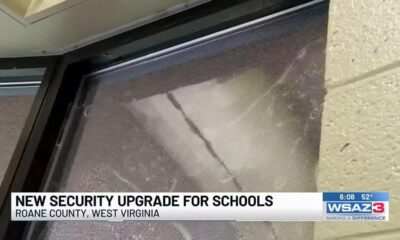
Roane County Schools installing security film on windows to protect students


