(The Center Square) – Judicial warfare is eroding the confidence in Americans’ justice system leaving a blight on justice itself, says a North Carolina congresswoman who leads the Rules Committee in the U.S. House of Representatives.
Rep. Virginia Foxx, R-N.C, is speaking out against judges blocking the president’s decisions as granted in the Constitution ahead of a Tuesday congressional hearing.
“As of late, we have certainly seen a slew of rulings by rogue judges that surpass their own constitutional authority,” she said in a post to social media Monday afternoon. “This is judicial warfare in the flesh. If it is not remedied in a commonsense and expeditious fashion, these exercises in partisanship will do further irreparable damage to the nation and to the confidence of Americans in our justice system.”
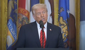
More than a dozen orders from President Donald Trump – more than in the entire time Joe Biden, Barack Obama and George W. Bush served as presidents – have been thwarted or attempted to be blocked. Among the judges in the spotlight is U.S. District Judge James Boasberg, a pivotal figure in deportation of people accused of being in gangs in addition to just being named to preside in a case involving military operations and a messaging app.
Boasberg, appointed by Bush to the Superior Court of the District of Columbia in 2002, was nominated to the federal bench by Obama and confirmed in the Senate 96-0 in 2012.
Boasberg on Wednesday issued and on Friday extended a temporary restraining order that prevents Trump from using the Alien Enemies Act to deport people believed to be part of the Venezuelan gang Tren de Aragua. A hearing, Judicial Overreach and Constitutional Limits on the Federal Courts, is at 10 a.m. Tuesday to be conducted jointly by the Subcommittee on Courts, Intellectual Property, Artificial Intelligence and the Internet, and the Subcommittee on the Constitution and Limited Government from within the Judiciar Committee of the U.S. House of Representatives.
California Republican Darrell Issa is chairman of the former committee, Texas’ Chip Roy the latter. North Carolina Democrat Deborah Ross is a minority member of the former; North Carolina Republican Mark Harris is a majority member of the latter.
Witnesses scheduled include former House Speaker Newt Gingrich and Cindy Romero, a victim of criminal activity believed perpetrated by Tren de Aragua in Aurora, Colo. Also on the invite list are witnesses from the Edwin Meese III Center for Legal and Judicial Studies at the Heritage Foundation.
Other federal judges drawing fire from supporters of the president include Biden appointees Amir Ali, Loren AliKhan, Deborah Boardman, Angel Kelley and Brendan Hurson; Obama appointees Paul Engelmayer, Amy Berman Jackson, John McConnell and Leo Sorokin; Bush appointee Joseph Laplante; Bill Clinton appointee William Alsup; and Ronald Reagan appointees John Coughenhour and Royce Lamberth.
“Without question,” Foxx said, “exceeding constitutional mandates as a matter of judicial philosophy does nothing more than blight justice itself.”