Local News Video
Meteorologist Trey Tonnessen: “Accurate Purrdictions” – Forecast

SUMMARY: consecutive weeks. The weather forecast for Thursday indicates that it will be lighter compared to the previous day, and this trend will continue into the weekend as a dry front moves through. The overall feeling will be more comfortable and fall-like as we move into next week. In terms of unemployment, there has been a slight change in the number of new claims, with 209,000 claims reported last week. However, this is still considered consistent with a healthy job market, as claims have remained below 210,000 for four consecutive weeks.

The low pressure that brought some measurable rainfall across the region yesterday as well as some gusty winds will continue to move downstream today. In the wake of the system, low level pressure field is breaking down allowing for winds to become lighter from west to east. Aloft, the parent wave will also continue downstream fairly rapidly in the active southwesterly flow aloft. In the wake of this feature, upper ridging will take shape through most of the short term period. Although the upper levels dry, there will remain a weak residual stationary front to our south. Also, low level pressure field is still cyclonic, so that in mind think it will be tough to rid the eastern tier of cloud cover quickly. West of I55, more insolation is anticipated so these areas are where the warmer temperatures will be found today with the coolest over the Mississippi Gulf Coast where low stratus may linger. Tonight, additional low stratus is likely to develop especially where we do clear and where we got just shy of 2.0″ of rain yesterday. Assuming there is some residual low level moisture/wet soils around, some radiational fog will develop as skies clear and winds go to near calm. At this juncture, think the best potential will be from McComb southward to Livingston and on south from there to Houma and points west. Added mostly patchy fog for now, but some locally dense fog cannot be ruled out in the more fog favored locations. Friday will start at least a brief warming trend again as upper heights/thicknesses continue to modestly increase. Temperatures out west may even approach 90 degrees along the Atchafalaya. Otherwise, sunny conditions should replace the cloud cover across the eastern tier for a bright end to the workweek.
Local News Video
Dream Home Giveaway supports St. Jude families

SUMMARY: The St. Jude Dream Home Giveaway supports families like Charlie’s, who benefited from the hospital’s free treatment for bone cancer. In 2020, after Charlie injured his shoulder, a specialist at St. Jude diagnosed him with Ewing sarcoma, leading to 14 rounds of chemotherapy and a limb-sparing surgery. The treatment, costing $2 million, was entirely free for the family, including housing, gas, and food. Now 15, Charlie helps raise millions for St. Jude and continues regular check-ups. The Dream Home Giveaway not only offers a chance to win a house but also supports the life-saving work at St. Jude.

Tickets for the home in Gulfport are $100, and proceeds benefit the St. Jude’s Children Hospital.
For more Local News from WLOX: https://www.wlox.com/
For more YouTube Content: https://www.youtube.com/channel/UCQZgBHlQMqHUV_hf4_9jLLQ
Local News Video
14-year-old receives encouraging words from Morgan Freeman ahead of Ground Zero performance

SUMMARY: Fourteen-year-old John Clayton White is set to perform at Ground Zero in Biloxi, drawing praise for his prodigious blues talent. Morgan Freeman, a co-owner of the venue with a distinguished career, shared his excitement during an interview. He emphasized the importance of nurturing young talent while recognizing the historical significance of blues music, which originated in Mississippi. Freeman expressed hope that the support from audiences would encourage Clayton to excel in his craft. The event promises a blend of rich musical heritage and emerging talent, aiming to provide a memorable entertainment experience. The show begins at 7 p.m. at Ground Zero.

14-year-old John Clayton White will take the stage at Ground Zero in Biloxi on Friday.
For more Local News from WLOX: https://www.wlox.com/
For more YouTube Content: https://www.youtube.com/channel/UCQZgBHlQMqHUV_hf4_9jLLQ
Local News Video
Happening April 18: World Autism Awareness Celebration

SUMMARY: On April 18, the Stevie Foundation will host a World Autism Awareness Celebration at Martin Luther King Park in Bay St. Louis from 5 to 7 PM. Danisha Johnson, a mother of a 5-year-old with autism, emphasizes the importance of community support and resources for families navigating autism spectrum disorder, which affects 1 in 36 children in the US. The event will feature food, fun, and a designated Easter egg hunt for the autistic community. To get involved, individuals can contact the foundation via email or Facebook to donate or learn more about resources.

Happening April 18: World Autism Awareness Celebration
For more Local News from WLOX: https://www.wlox.com/
For more YouTube Content: https://www.youtube.com/channel/UCQZgBHlQMqHUV_hf4_9jLLQ
-

 News from the South - Arkansas News Feed7 days ago
Measles cases confirmed in Arkansas children after travel exposure
-

 News from the South - Alabama News Feed7 days ago
Impacts of Overdraft Fees | April 11, 2025 | News 19 at 10 p.m.
-

 Mississippi Today5 days ago
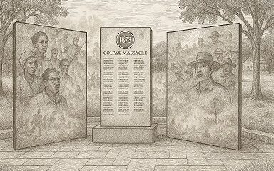
On this day in 1873, La. courthouse scene of racial carnage
-

 News from the South - Georgia News Feed7 days ago
1-on-1 with Gov. Kemp’s Senior Advisor | Full interview
-

 News from the South - Missouri News Feed7 days ago
Mom and son targeted in carjackings, stolen cars crime spree
-

 Local News6 days ago
AG Fitch and Children’s Advocacy Centers of Mississippi Announce Statewide Protocol for Child Abuse Response
-

 Local News5 days ago
Southern Miss Professor Inducted into U.S. Hydrographer Hall of Fame
-

 News from the South - Arkansas News Feed7 days ago
Federal investigators looking into cause of deadly NYC helicopter crash


