News from the South - Louisiana News Feed
KSAT 12 Nightbeat : Oct 14, 2024
SUMMARY: San Antonio police are investigating a fatal shooting that occurred on East Grayson, near Broadway. A man was found dead inside a silver car, suffering from multiple gunshot wounds. Witnesses reported hearing 10 to 20 rounds of gunfire. The suspects remain unidentified, with police searching the area for evidence. In another case, the search continues for Suzanne Clark Simpson, a missing mother. Her husband, currently in jail for unrelated charges, has not been charged in her disappearance. Meanwhile, the Bear County Sheriff discussed rising dog attacks and efforts to track vicious dogs, alongside updates on several local crime stories.

The KSAT 12 News Team provides a look at local, regional, statewide and national news events and the latest information on local traffic and weather issues.


News from the South - Louisiana News Feed
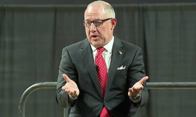
Rep. Knox proposes tip tax exemption for Louisiana workers
SUMMARY: Rep. Alonzo Knox from New Orleans has introduced a bill to exempt tips from state income tax for Louisiana workers, aiming to provide tax relief to those in the hospitality industry, which supports 72,000 jobs in New Orleans. Many workers rely on tips, and Knox’s proposal would allow them to deduct tip income from their taxes. However, some experts, like Yon Mohler from Invest Louisiana, warn that this could reduce state revenue during challenging economic times and suggest implementing a meaningful state minimum wage instead. Knox anticipates bipartisan support for the bill, which targets individuals earning less than $65,000 annually.

Lawmakers are due back in Baton Rouge on April 14 for the start of this year’s regular session.
News from the South - Louisiana News Feed
Deadly shootings at phone repair shop add to concerns for neighbors
SUMMARY: A recent shootout at a San Antonio cell phone repair shop left two men dead, causing alarm among local residents. The incident involved 47-year-old Kenneth Mcnite Jr., who fatally shot employee Cody Bell, 35, before being killed by another worker. This violence adds to community fears following the unsolved murder of 28-year-old Maria Delles Labrador nearby. Residents express worry about safety, with some feeling the need to carry firearms for protection, particularly due to the proximity of violence to local establishments, including children’s swimming classes. The area is increasingly perceived as dangerous by locals.

A shooting at a cell phone repair shop on the far Northwest Side Tuesday afternoon is adding to concerns that people who live in the area already had.
News from the South - Louisiana News Feed
U.S. House Democrats say NOAA cuts will harm weather forecasting, fisheries, Navy operations
by Jacob Fischler, Louisiana Illuminator
April 2, 2025
Democrats on the U.S. House Natural Resources Committee and a panel of experts on Wednesday blasted the Trump administration’s reduction to the National Oceanic and Atmospheric Administration’s budget and workforce, citing consequences for everyday weather data, national security and affected industries.
Virtually every American interacts with NOAA’s weather data, which supplies forecasting services across the country.
The agency’s climate and oceanic research supports the U.S. Navy’s operations and even the commercial fishing industry – described during the forum as having “a love-hate relationship” with the agency – depends on NOAA to open and close fisheries, the lawmakers and experts said.
But those missions were imperiled in February by the firings of 7% of NOAA’s staff of scientists and others overseeing federal research and monitoring of weather and oceans, the group of Democrats said.
“These critical functions are being dismantled by the sweeping, indiscriminate layoffs of nonpartisan public servants and facility closures,” U.S. Rep. Seth Magaziner, a Rhode Island Democrat who led the forum, said.
The reductions in force at NOAA, which houses agencies including the National Weather Service, National Ocean Service, National Marine Fisheries Service, National Environmental Satellite, Data, and Information Service and the Office of Oceanic and Atmospheric Research, were part of across-the-board cuts to the federal workforce sought by President Donald Trump and billionaire White House adviser Elon Musk.
The group of Democrats, who met without involvement of the committee’s Republican majority, said the cuts would hurt a wide range of Americans who depend on the agency’s data collection and rulemaking.
Data collection and dissemination
One of NOAA’s core missions is collecting and publishing weather data across the country used in forecasting apps and other common sources of weather information.
“There is no weather forecast that’s produced in this country that isn’t dependent on NOAA, none” Mary Glackin, a former deputy under secretary for operations at the agency under presidents of both parties, said.
The availability of federal data made possible the creation of companies like Accuweather, which started by collecting data in a garage, Glackin said.
U.S. Navy Rear Admiral Jon White told the panel NOAA’s extensive forecasting data was also critical to naval operations, saying reductions in that data would hurt the military’s readiness, both shipping out of domestic stations and in potential conflict zones.
“Hurricane forecasting and typhoon forecasting rely on the data from NOAA, whether it’s satellite data,” White said. “Reductions in that data and that information provide critical threats to our military infrastructure. Ships that (start) out of Norfolk and San Diego rely on that information about upcoming storms, especially hurricanes on the East Coast. … It’s not just billions of dollars of ship damage: It’s lives that are at stake.”
Industry needs NOAA
Magaziner was the one who called the commercial fishing industry’s connection with NOAA “a love-hate relationship,” but he and witnesses noted that the agency oversees the most basic functions the industry needs to operate.
Sarah Schumann, a fisherman with operations in Rhode Island and Alaska, criticized President Joe Biden’s administration for allying too strongly with offshore wind developers, but said the new administration’s actions were also detrimental to the industry.
“These cuts will bog down the agency’s ability to serve the public for fishermen,” Schumann said. “Because of climate change, we desperately need faster, more nimble and more collaborative data collection and decision-making, and there is a very slim chance we’re going to get that with this.”
Trump’s slowdown of regulations – requiring federal agencies to withdraw 10 regulations for every one new regulation put into place – has also hampered commercial fishing operations.
Opening and closing fisheries for a season are done through NOAA rulemaking, environmental attorney Lizzie Lewis told the panel. Bluefin tuna fisheries were not closed on time and were overfished by 125% and fisheries in New England are unlikely to open on time, she said.
Efficiency?
The cuts, part of Musk’s initiative to make government more efficient, are not having their intended effect in streamlining government, Magaziner and others on the panel, including New Mexico’s Melanie Stansbury, said.
“The assertion that mass layoffs will somehow improve efficiency is not only misleading, it is outright dangerous,” Magaziner said. “Real people, real jobs and real lives are on the line. Without NOAA’s real-time data, emergency responders are left without the critical information they need to respond to impending disasters like wildfires, hurricanes, floods and severe storms putting millions at risk.”
The layoffs also decimated morale at the agency and made attracting qualified young people to its public service mission more difficult, Lewis told the panel.
“We are losing an entire generation of scientists and leaders who can help this country,” Lewis said. “We can keep its people safe and can grow its economy. And that to me is the devastating human cost.”
Last updated 5:08 p.m., Apr. 2, 2025
Louisiana Illuminator is part of States Newsroom, a nonprofit news network supported by grants and a coalition of donors as a 501c(3) public charity. Louisiana Illuminator maintains editorial independence. Contact Editor Greg LaRose for questions: info@lailluminator.com.
The post U.S. House Democrats say NOAA cuts will harm weather forecasting, fisheries, Navy operations appeared first on lailluminator.com

Measles can ravage the immune system and brain, causing long-term damage – a virologist explains

New Tariffs Could Raise Car Prices | April 2, 2025 | News 19 at 10 p.m.

Miami businesses prepare to absorb costs amid new tariffs

Weather Fun 1on1: Brylee explains why thunderstorms occur more often in the summer than in the wi…
‘Ole Miss basketball isn’t going anywhere’: Rebels stave off attempt by Texas A&M to poach Chris Beard

UMD introduces Buzz Williams as new men’s basketball coach | NBC4 Washington

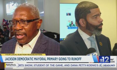
Jackson Democratic mayoral primary heads to runoff

California quashes bill to ban males from female sports, facilities | California

Family files wrongful death lawsuit against Colonial Heights rehab center

Mississippi legislative session to end without lawmakers passing budget

Pharmacy benefit manager reform likely dead

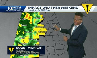
Severe storms will impact Alabama this weekend. Damaging winds, hail, and a tornado threat are al…

University of Alabama student detained by ICE moved to Louisiana

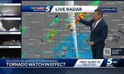
Tornado watch, severe thunderstorm warnings issued for Oklahoma

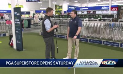
A little early morning putting at the PGA Tour Superstore

Youngkin removes Ellis, appoints Cuccinelli to UVa board | Virginia

Peanut farmer wants Florida water agency to swap forest land

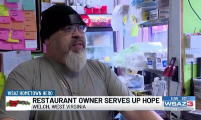
Hometown Hero | Restaurant owner serves up hope

Georgia road project forcing homeowners out | FOX 5 News

Artificial intelligence experiment begins in North Carolina treasurer’s office | North Carolina
New Tariffs Could Raise Car Prices | April 2, 2025 | News 19 at 10 p.m.
Miami businesses prepare to absorb costs amid new tariffs
Weather Fun 1on1: Brylee explains why thunderstorms occur more often in the summer than in the wi…
UMD introduces Buzz Williams as new men’s basketball coach | NBC4 Washington
Jackson Democratic mayoral primary heads to runoff
Family files wrongful death lawsuit against Colonial Heights rehab center

Trump announces new tariffs | REACTION

Rep. Knox proposes tip tax exemption for Louisiana workers

Deadly shootings at phone repair shop add to concerns for neighbors

Jimmy Patronis’ first speech as Florida Congressman | Full speech
-

 Mississippi Today1 day ago
Pharmacy benefit manager reform likely dead
-
News from the South - Alabama News Feed6 days ago
Severe storms will impact Alabama this weekend. Damaging winds, hail, and a tornado threat are al…
-
 News from the South - Alabama News Feed5 days ago
University of Alabama student detained by ICE moved to Louisiana
-
News from the South - Oklahoma News Feed4 days ago
Tornado watch, severe thunderstorm warnings issued for Oklahoma
-
News from the South - Kentucky News Feed6 days ago
A little early morning putting at the PGA Tour Superstore
-
 News from the South - Virginia News Feed6 days ago
Youngkin removes Ellis, appoints Cuccinelli to UVa board | Virginia
-
News from the South - Florida News Feed7 days ago
Peanut farmer wants Florida water agency to swap forest land
-
News from the South - West Virginia News Feed5 days ago
Hometown Hero | Restaurant owner serves up hope