News from the South - North Carolina News Feed
How did wildlife and feral cats fare after Helene? Tell me again why we’re boiling water? Arts grants MIA? • Asheville Watchdog
Today’s round of questions, my smart-aleck replies and the real answers:
Question: In your Helene reportage, will you address the impact the storm made on wildlife — bears in their dens, small land animals unable to climb trees, etc.? While I know some organizations found cats, there hasn’t been any mention of how all these animals fared.
My answer: If any critters can survive an ecological apocalypse, I’d put my money on feral cats. OK, maybe my dogs because they’d be asleep on the couch.
Real answer: The main message from the North Carolina Wildlife Resources Commission is that it’s going to be assessing this for a long time. But here are some of the highlights from various WRC staffers, starting with spokesperson Anna Gurney, who compiled this information for me.
“It will likely be some time before the damage to WRC infrastructure is known, but the Armstrong State Fish Hatchery in Marion was severely damaged, and staff from that facility had to be evacuated by helicopter,” Gurney said. “All 600,000 trout were lost. Fall Delayed Harvest trout stockings have been suspended until staff can assess damage to facilities and delayed harvest stream locations.”
Restocking may start this month, depending on staffing, Gurney said.
“All other hatchery facilities received minimal damage and have resumed normal operations,” she added.
Regarding bears, Colleen Olfenbuttel, a black bear and furbearer biologist with the commission, had good news.
“Bears are resilient and can easily escape flood water and the storm,” Olfenbuttel said. “We also had six rehabbed bear cubs on the ground with GPS collars, and while they were not right in the ‘impact’ zone of Asheville, they are all alive and well. Based on their locations, they settled down during the storm and are now on the move again.”
The news was not so great for hellbenders, the large amphibians that live in our mountain streams and rivers. They’re unusual critters with a flat head and a paddle-like tail.
“Initial reports are that hellbenders appear to have taken a major hit across multiple counties and watersheds,” said Lori Williams, a biologist and hellbender expert with the WRC. “People are reporting finding them hundreds of feet away from rivers, stuck in mud ditches, piles of storm debris, and washed out in open fields.”
A lot of dead ones have been uncovered in storm cleanup.
“Immediately after the storm, there were some still alive that good-hearted folks put back in rivers,” Williams said. They’ve received reports about displaced hellbenders from Transylvania, Avery, Watauga and Ashe counties.
Williams said the population assessment will take time because so many rivers sustained such heavy damage.
“We anticipate habitat damage and/destruction in most watersheds, meaning loss and displacement of shelter rocks, nest rocks, and nests themselves, which would have had eggs soon to hatch this time of year,” Williams said.
She expects more damage to surface in the coming weeks. Here in Buncombe, Williams noted that the population of hellbenders in the Swannanoa River was “barely hanging on before Helene.
“Seeing what happened to that river now, are any hellbenders left in there at all?” Williams said. “Would be a low chance, in my opinion.”
Eastern Hellbenders are listed as a “state species of special concern.” They have small, isolated populations in a limited number of creeks in the state, biologists say.
Biologists say they’ll have to start from scratch in the hardest-hit rivers, and then do more in-depth monitoring in the coming months and years.
Miranda Turner, a WRC wildlife health biologist in the Game and Furbearer program, said wildlife can be affected in numerous ways when a large storm like Helene hits.
During the storm, rising waters likely displaced animals from dens and nests, especially in low-lying areas.
High winds caused birds and bats to alter their flying behavior to seek shelter, which affects foraging. Aquatic animals may have to go to new areas to seek shelter.
“Many species of birds were migrating in late September when the hurricane hit, and as a result biologists have found birds blown far off their typical migratory paths and species are being found in atypical locations — such as birds that are usually only found over the ocean being spotted inland,” Turner said.
Turner also noted that all the debris that’s washed up on creek and river banks will likely cause water quality issues for months. Pollution could also have long-term effects.
I’ll note that in a recent Buncombe County daily briefing, French Broad Riverkeeper Hartwell Carson, who works for the nonprofit MountainTrue, said he had not seen any large fish kills along the French Broad.

// Photo credit: North Carolina Wildlife Resources Commission
Turner pointed out one possible impact I hadn’t really thought about — the loss of human-made infrastructure. You may think it would be a positive to remove this, but “in reality many wildlife species use human-made structures extensively and have been displaced from their homes by the loss of these structures,” Turner said.
“Western North Carolina is known to have many species of bats that roost in bridges, including federally endangered gray bats,” Turner said. “With the loss of multiple bridges due to flooding, it is unknown whether these roosts and bats survived the storm, and it will take many months for the infrastructure in the area to improve enough that biologists will be able to access these areas to check on the bat populations.”
She noted other threatened or endangered species, such as the southern bog turtle, Hickory Nut Gorge green salamander, and the Carolina northern flying squirrel, that the commission will not be able to assess until infrastructure improves.
All of the storm disturbance could contribute to disease outbreaks in wildlife.
“Animals such as black bears, raccoons, skunks, and opossums are already taking advantage of the plentiful trash and rotting food to forage in urban areas more than they had been prior to the storm,” Turner said. “When many animals congregate in small areas, the potential for a disease outbreak is much greater.”
Also, standing water after the flood raises the risk for vector-borne illnesses spreading in wildlife, such as West Nile virus transmitted by mosquitoes.
“NCWRC staff will be carefully monitoring for the spread of any diseases in the wildlife in the Hurricane Helene impacted areas during the upcoming months, and currently there have been no unusual signs of disease in the area,” Turner said.
The commission on Oct. 4 noted in a news release that it was receiving reports of an increase in human-black bear interactions in Asheville and Buncombe County, in part because of more trash in area, unattended food donations, and “the attractiveness of rotting foods, particularly in damaged homes and businesses.”
Regarding feral cats, the Asheville Humane Society told me that’s not something it tracks and referred me to Sister Kitten Animal Rescue in Maggie Valley. Executive Director Eric Phelps said their impression is that it’s sort of a mixed bag — undoubtedly, some cats got caught off guard by the quickly rising waters and drowned, but they’ve also found quite a few survivors in unexpected places.
He noted that feral cat colonies are “pretty ubiquitous all over the area.
“And we had several colonies that we feed over in the River Arts District, actually right by Asheville Paper Company, which got completely wiped out,” Phelps told me. “There’s about a dozen cats there that we’ve been feeding the last few years, and we had no idea if they were able to survive or not.”
They had guessed they got wiped out because cats tend to look to climb trees or other objects when faced with rising waters, and there was really nowhere to go when the French Broad rose out of its banks.
“Once the water receded enough, we got over there to the location where we had been feeding previously, and we started feeding again,” Phelps said. “Finally, we got a game camera up a couple of weeks ago, and we’re seeing about half the colony has returned, which is pretty striking, because some of these cats are elderly.”
With the lack of trees to climb, Phelps isn’t sure how they made it.
“They must have run like hell to get away from the water,” he said.
Further north in the RAD, a woman feeds a couple of colonies, maybe a dozen cats total, near the Jeff Bowen Bridge, Phelps said.
“And all of her cats returned — all of them,” Phelps said. “She got them all back, even the ones under the bridge that were at water level. Those cats apparently got away from the water. And once she was able to start feeding over there again, they all came back.”
In other places, though, particularly mobile home parks, Phelps said the loss of life was probably more significant, as feral cats facing flood waters will often climb up underneath the homes seeking shelter.
He said his organization also has been searching for owned pets, and he got a hit on a game camera for a woman’s pet cat in Swannanoa recently. That cat lived in a home that flooded to the roof line, Phelps said, adding that the cat had been distinctively groomed before the storm so he’s pretty certain it’s the right animal.
“She hasn’t been back in the neighborhood, but now she’s back, moving around in the neighborhood, looking for food or trying to find her mom,” Phelps said. “It’s taken over a month for her to come back. So I guess the message there is, don’t give up hope.”


Question: I’ve gotten quite a few questions from readers about the City of Asheville’s boil water notice, which remains in effect. I’ll summarize: If the city is super-chlorinating the water it’s sending out from the North Fork Reservoir, that should kill pathogens. So what good does heating up the water to the boiling point do? Isn’t that just boiling the clay and other minerals in the water without getting rid of them?
My answer: In my book, nothing tastes finer than a nice cup of hot clay water with just the right dash of aluminum sulfate for smoothness.
Real answer: I posed this question to Asheville Water Resources Department spokesperson Clay Chandler at the Buncombe County Helene briefing Monday.
“So that’s to eliminate any bacteria that may be in the water by the time it reaches your tap,” Chandler said. “Boiling water is going to kill bacteria. It’s not going to reduce the level of things like chlorine, aluminum, iron and manganese. It’s specifically designed to kill things like E coli and coliform, none of which we’ve had a positive for in the distribution system, by the way, since we’ve been testing.”
The city still recommends using bottled water for consumption and using tap water for non-consumption uses such as showering and flushing toilets. The upshot is that you could drink the boiled water (boil for at least one minute), if you had no access to any other drinking water, but you’re better off drinking bottled water if you can get it.
“We are presenting every bit of information that we have, and if somebody is comfortable boiling the water and consuming it, that’s certainly up to them,” Chandler said. “Bottled water for consumption, or water from an alternate source for consumption is recommended if it’s available. If it’s not available — there’s just no way under the sun that somebody can get their hands on purified water — they can boil it for a minimum of one minute beforehand, before any kind of consumption.”
You can find an extensive list of frequently asked questions on the water department’s Helene recovery page, and that includes a lot of information about boiling water and the minerals currently in the water. Also, check out Asheville Watchdog’s most recent story about the city’s water restoration efforts.
Question: Explore Asheville has been saying for weeks that they will be distributing grants to local tourism-related businesses, but they’ve yet to “stand up” an application. Considering the amount of money they have access to, I’m wondering why it’s taking so long for them to do something for the businesses who’ve helped fund them.
My answer: Hey, I have no more luck getting Explore Asheville to answer questions than you do.
Real answer: Seriously, I really don’t. I sent this question over to Explore Asheville on Oct. 23 and got a few assurances they were working on it. Then they put out a news release Oct. 31 saying they’re now accepting applications for the Always Asheville Fund, which they established Oct. 9.
The fund will “support small, independent travel and hospitality businesses throughout Asheville and Buncombe County in reopening after the devastating impacts of Hurricane Helene. More than $750,000 will be available in microgrants ranging from $5,000 to $10,000.”
Explore Asheville is a subsidiary of the Buncombe County Tourism Development Authority, which has a $34 million budget this year.
Asheville Watchdog is a nonprofit news team producing stories that matter to Asheville and Buncombe County. Got a question? Send it to John Boyle at jboyle@avlwatchdog.org or 828-337-0941. His Answer Man columns appear each Tuesday and Friday. The Watchdog’s reporting is made possible by donations from the community. To show your support for this vital public service go to avlwatchdog.org/support-our-publication/.
Related
The post How did wildlife and feral cats fare after Helene? Tell me again why we’re boiling water? Arts grants MIA? • Asheville Watchdog appeared first on avlwatchdog.org


News from the South - North Carolina News Feed
White House officials hold prayer vigil for Charlie Kirk
SUMMARY: Republican lawmakers, conservative leaders, and Trump administration officials held a prayer vigil and memorial at the Kennedy Center honoring slain activist Charlie Kirk, founder of Turning Point USA. Kirk was killed in Utah, where memorials continue at Utah Valley University and Turning Point USA’s headquarters. Police say 22-year-old Tyler Robinson turned himself in but has not confessed or cooperated. Robinson’s roommate, his boyfriend who is transitioning, is cooperating with authorities. Investigators are examining messages Robinson allegedly sent on Discord joking about the shooting. Robinson faces charges including aggravated murder, obstruction of justice, and felony firearm discharge.
White House officials and Republican lawmakers gathered at the Kennedy Center at 6 p.m. to hold a prayer vigil in remembrance of conservative activist Charlie Kirk.
https://abc11.com/us-world/
Download: https://abc11.com/apps/
Like us on Facebook: https://www.facebook.com/ABC11/
Instagram: https://www.instagram.com/abc11_wtvd/
Threads: https://www.threads.net/@abc11_wtvd
TIKTOK: https://www.tiktok.com/@abc11_eyewitnessnews
News from the South - North Carolina News Feed
Family, friends hold candlelight vigil in honor of Giovanni Pelletier
SUMMARY: Family and friends held a candlelight vigil in Apex to honor Giovanni Pelletier, a Fuquay Varina High School graduate whose body was found last month in a Florida retention pond. Giovanni went missing while visiting family, after reportedly acting erratically and leaving his cousins’ car. Loved ones remembered his infectious smile, laughter, and loyal friendship, expressing how deeply he impacted their lives. His mother shared the family’s ongoing grief and search for answers as authorities continue investigating his death. Despite the sadness, the community’s support has provided comfort. A celebration of life mass is planned in Apex to further commemorate Giovanni’s memory.
“It’s good to know how loved someone is in their community.”
More: https://abc11.com/post/giovanni-pelletier-family-friends-hold-candlelight-vigil-honor-wake-teen-found-dead-florida/17811995/
Download: https://abc11.com/apps/
Like us on Facebook: https://www.facebook.com/ABC11/
Instagram: https://www.instagram.com/abc11_wtvd/
Threads: https://www.threads.net/@abc11_wtvd
TIKTOK: https://www.tiktok.com/@abc11_eyewitnessnews
SUMMARY: The North Carolina Courage defeated Angel City FC 2-1 in Cary, ending their unbeaten streak. Monaca scored early at the 6th minute, followed by Bull City native Brianna Pinto’s goal at the 18th minute, securing a 2-0 halftime lead. Angel City intensified in the second half, scoring in the 88th minute, but the Courage held firm defensively to claim victory. Pinto expressed pride in the win, emphasizing the team’s unity and playoff ambitions. Nearly 8,000 fans attended. Coverage continues tonight at 11, alongside college football updates, including the Tar Heels vs. Richmond game live from Chapel Hill.
Saturday’s win was crucial for the Courage as the regular season starts to wind down.
https://abc11.com/post/north-carolina-courage-wins-2-1-angel-city-fc/17810234/
Download: https://abc11.com/apps/
Like us on Facebook: https://www.facebook.com/ABC11/
Instagram: https://www.instagram.com/abc11_wtvd/
Threads: https://www.threads.net/@abc11_wtvd
TIKTOK: https://www.tiktok.com/@abc11_eyewitnessnews
The Sound of the South: Mississippi’s Songbook

Prosecutors already have dropped nearly a dozen cases from Trump’s DC crime surge, judge says

15-minute parking spots added in downtown Gulfport to ease congestion during renovations

Statewide literacy meetings aim to boost reading skills and family engagement
Rep. Bennie Thompson calling on federal investigation into Delta State student’s death

A Sanctuary in Goodman: The Magic of the Public Library

Suspect in Charlie Kirk killing is charged with murder as prosecutor says DNA found on rifle trigger

Hyde-Smith, Warnock team up to recognize Gold Star Families Remembrance Week

FDA takes aim at Hims and other telehealth services in drug advertising blitz

Saints Report: Saints lose another close game this time in week two against the San Francisco 49ers

What we know about Charlie Kirk shooting suspect, how he was caught

Russian drone incursion in Poland prompts NATO leaders to take stock of bigger threats

Introducing our WXXV Student Athlete of the Week, St. Patrick’s Parker Talley!

Federal hate crime charge sought in Charlotte stabbing | North Carolina

Weapon recovered as manhunt continues in Kirk assassination investigation | National

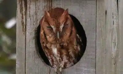
Screech Owls – Small but Cute

News 5 NOW at 8:00am | September 11, 2025

NW Arkansas Championship expected to bring money to Rogers

Middle Tennessee State University dean filed over Kirk comments | Tennessee

Haynes wanted in on Wildlife bribery scheme too, informant says
15-minute parking spots added in downtown Gulfport to ease congestion during renovations
Statewide literacy meetings aim to boost reading skills and family engagement
Saints Report: Saints lose another close game this time in week two against the San Francisco 49ers

Harrison County approves budget with no tax increase

‘Little quiet light’: Family remembers Delta State University student found dead on campus

The Mustard Seed

WXXV Game of the Week: Week 3

White House officials hold prayer vigil for Charlie Kirk

Jonesboro band culture responsible for global legacy | FOX 5

Family, friends hold candlelight vigil in honor of Giovanni Pelletier
-

 News from the South - North Carolina News Feed6 days ago
What we know about Charlie Kirk shooting suspect, how he was caught
-
Local News7 days ago
Russian drone incursion in Poland prompts NATO leaders to take stock of bigger threats
-
Local News Video7 days ago
Introducing our WXXV Student Athlete of the Week, St. Patrick’s Parker Talley!
-
 News from the South - North Carolina News Feed6 days ago
Federal hate crime charge sought in Charlotte stabbing | North Carolina
-
The Center Square7 days ago
Weapon recovered as manhunt continues in Kirk assassination investigation | National
-
Our Mississippi Home4 days ago
Screech Owls – Small but Cute
-
News from the South - Alabama News Feed7 days ago
News 5 NOW at 8:00am | September 11, 2025
-
News from the South - Arkansas News Feed5 days ago
NW Arkansas Championship expected to bring money to Rogers