News from the South - Alabama News Feed
Deadly Shooting In Tuscumbia Sunday | October 7, 2024 | News 19 at 6 p.m.
SUMMARY: Police are investigating a shooting that occurred on Sunday night on Pali Johnson Memorial Drive, where 28-year-old Nathan Littleton was found with multiple gunshot wounds. Witnesses at the scene are being interviewed, and Littleton’s body has been sent for an autopsy to gather more evidence. Authorities aim to determine the specifics of the gunshot wounds to guide their investigation and potential criminal charges. They emphasize the importance of gathering factual evidence before making any arrests or charging suspects in the case.

One person was killed Sunday night following a shooting in Tuscumbia, according to police.
News 19 is North Alabama’s News Leader! We are the CBS affiliate in North Alabama and the Tennessee Valley since November 28, 1963.
https://whnt.com/
https://www.facebook.com/whntnews19
https://www.instagram.com/whntnews19/
https://twitter.com/whnt


News from the South - Alabama News Feed
University of Alabama student detained by ICE moved to Louisiana
by Alander Rocha, Alabama Reflector
March 28, 2025
Federal immigration officials have moved an an University of Alabama graduate student to an Immigration and Customs Enforcement (ICE) detention facility in Jena, Louisiana.
An attorney for Alireza Doroudi confirmed Friday afternoon after the ICE detainee locator listed where he was detained. For several days, the detainee locator only stated he was “in ICE custody” but did not list any location. The facility in Jena is holding several international students targeted by federal authorities.
David Rozas, Doroudi’s attorney, disputed claims by the U.S. Department of Homeland Security that his client posed a national security concern.
GET THE MORNING HEADLINES.
Doroudi, an Iranian national pursuing a PhD in mechanical engineering, was taken into custody by ICE’s Homeland Security Investigations (HSI) unit on Tuesday around 3 a.m., Rozas said in a statement sent on Friday. Immigration authorities cited the U.S. State Department’s revocation of Doroudi’s student visa as the reason for his arrest.
A Department of Homeland Security spokesperson said Doroudi “posed significant national security concerns.” The spokesperson declined to provide further details about what the concerns were, saying “That is all we are able to share at this time.”
Rozas challenged that characterization, saying he was unaware “of any allegations concerning significant national security issues.”
“He has not been arrested for any crime, nor has he participated in any anti-government protests,” the statement from Rozas said. “He is legally present in the U.S., pursuing his American dream by working towards his doctorate in mechanical engineering.”
Rozas added that Doroudi’s student visa was still active and that he was in the early stages of applying for permanent residency as a researcher.
Student organizers from the Students for Justice in Palestine, a student organization at UA, said Thursday that Doroudi had no involvement in recent pro-Palestine protests at the university or with the organization.
Doroudi’s fiancé, Sama Ebrahimi Bajgani, started a GoFundMe to help cover his legal expenses, garnering over $21,000 in about a day. She said in a LinkedIn post that Doroudi’s is set to defend his dissertation next academic year and has been “fully engaged” in academic work and research projects in the department.
“His dedication and achievements have earned him recognition in his field and led to his selection to apply for permanent residency,” she wrote in a post.
The University of Alabama has not provided further details about the situation. Spokesperson Alex House did not respond to messages Friday after initially stating that the university was cooperating with immigration authorities. House did not address whether the university was offering Doroudi any assistance.
YOU MAKE OUR WORK POSSIBLE.
Alabama Reflector is part of States Newsroom, a nonprofit news network supported by grants and a coalition of donors as a 501c(3) public charity. Alabama Reflector maintains editorial independence. Contact Editor Brian Lyman for questions: info@alabamareflector.com.
The post University of Alabama student detained by ICE moved to Louisiana appeared first on alabamareflector.com
News from the South - Alabama News Feed
HPD: Crime Rates Down Despite Growing Population | March 28, 2025 | News 19 This Morning
SUMMARY: Despite a 20% population growth over the past five years, Huntsville’s crime rate has significantly decreased, according to the Huntsville Police Department (HPD). Major crimes have dropped by 26%, and violent crimes have decreased by 39%. HPD credits strong community engagement and public cooperation for this positive trend. While drug crimes, particularly related to fentanyl and methamphetamine, remain a challenge, new technologies, faster officer response times, and collaboration with other agencies have contributed to the reduction in crime. HPD emphasizes the vital role of the community in improving safety and reducing crime rates.

8 a.m. Newscast
News 19 is North Alabama’s News Leader! We are the CBS affiliate in North Alabama and the Tennessee Valley since November 28, 1963.
https://whnt.com/
https://www.facebook.com/whntnews19
https://www.instagram.com/whntnews19/
https://twitter.com/whnt
News from the South - Alabama News Feed
GE Vernova celebrates new customer experience center as employees work to meet demands for electrici
SUMMARY: GE Vernova celebrated the opening of a new customer experience center at its Pensacola Factory, which manufactures key components for onshore wind turbines. The facility, the largest of its kind globally, is critical in meeting growing demands for renewable energy. It is currently producing turbines for a massive wind farm in New Mexico and additional projects in Texas. GE Vernova has invested $70 million since 2023 to expand the facility, aiming to boost electricity production. With over 600 employees, including veterans, the company plans to further grow, potentially reaching 1,000 workers as it continues to support electrification and decarbonization efforts.

A ribbon cutting ceremony took place Thursday for a new customer experience center at GE Vernova’s Pensacola factory.
FULL STORY: https://trib.al/DAvDwk6

WCBB: Ole Miss falls to UCLA 76-62 in Sweet 16

Op-Ed: Now is the time for members of Congress to support efforts that combat obesity | Pennsylvania

Muggy mornings this weekend with afternoon sunshine

Georgetown concerned affordable housing bill could hurt future of historic downtown

New 3D technology could soon bring surgeons closer to patients in Africa’s most remote regions
MCBB: Michigan State outlasts Ole Miss 73-70 in Sweet 16 nail-biter

New US strikes against Houthi rebels kill at least 1 in Yemen

Colorado General Assembly passes controversial gun bill | Colorado

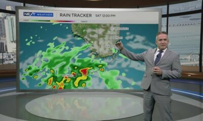
South Florida weather for Friday 3/28/25

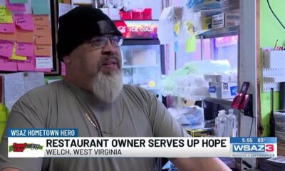
Hometown Hero | Restaurant owner serves up hope

Local pharmacists advocating for passage of bill limiting control of pharmacy benefit managers

DeSantis returns millions in federal funds as Florida cities receive DOGE letters

Florida boy 'tortured' by mom, her boyfriend dies weeks after hospitalization, police say

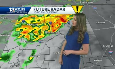
Impact Weather Sunday: Tracking threat of strong storms in the Alabama forecast with hail & gusty…

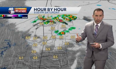
Active weather threat tonight

Family mourns death of 10-year-old Xavier Williams

LIVE: SpaceX NROL-69 mission launch

South Carolina: Voluntary evacuations underway near Table Rock State Park fire

Report: Proposed Medicaid, SNAP cuts would cost Arkansas thousands of jobs, $1B in GDP

Classmates remember college student hit by car, killed near NC State
Muggy mornings this weekend with afternoon sunshine
Georgetown concerned affordable housing bill could hurt future of historic downtown
South Florida weather for Friday 3/28/25
Hometown Hero | Restaurant owner serves up hope

Hammer-wielding man arrested for assaults on law enforcement officers in Lee County

Popular online food critic surprises Houston-area dessert shop with $50,000 donation

Puro Picks: Social media influencer Stephanie Guerra discusses weekend events in San Antonio

VA Plans 80,000 Job Cuts for Efficiency

Evening weather forecast 3/28/2025

Jay's Evening Weather 03/28/25
-

 Local News Video5 days ago
Local pharmacists advocating for passage of bill limiting control of pharmacy benefit managers
-
News from the South - Florida News Feed6 days ago
DeSantis returns millions in federal funds as Florida cities receive DOGE letters
-
News from the South - Florida News Feed6 days ago
Florida boy 'tortured' by mom, her boyfriend dies weeks after hospitalization, police say
-
News from the South - Alabama News Feed7 days ago
Impact Weather Sunday: Tracking threat of strong storms in the Alabama forecast with hail & gusty…
-
News from the South - Arkansas News Feed7 days ago
Active weather threat tonight
-
News from the South - Florida News Feed3 days ago
Family mourns death of 10-year-old Xavier Williams
-
News from the South - Florida News Feed5 days ago
LIVE: SpaceX NROL-69 mission launch
-
News from the South - South Carolina News Feed7 days ago
South Carolina: Voluntary evacuations underway near Table Rock State Park fire