News from the South - North Carolina News Feed
Asheville’s messaging on lead in its water was mishandled — and other lessons from the Helene outage • Asheville Watchdog
Now that potable water has been restored to Asheville’s 63,000 customers, this is a good time to reflect on how the city handled the crisis and the lessons we’ve learned.
You may recall the great holiday water outage of 2022-2023 – that one didn’t go so great for the city, and folks lacked water for 11 days. This time, it took the city 52 days to restore drinking water, although non-potable water returned in mid-October.
Given the devastation from Tropical Storm Helene, it makes sense the water was out much longer. Both main transmission lines and the bypass line coming from North Fork Reservoir, which provides 80 percent of Asheville’s drinking water, washed out, as well as a lot of smaller distribution lines.
And the 350-acre lake itself essentially turned upside down, leaving the city stuck with muddy water it could not filter or treat.
So let’s get started with these lessons we all learned, including the most obvious:
We’ll never take water for granted again
I live in Fletcher and lost potable water for only a few days. And that was a pain.
Buying and lugging water sucks. And folks on Asheville’s system had no water at all until mid-October, and no potable water until Nov. 18.
Nothing will make you appreciate something like going without it.
The repair crews did an amazing job

After visiting North Fork Reservoir on Nov. 11, I really got an idea of what a monumental repair job contracting crews faced in restoring the washed-out transmission lines and fixing the road they run beneath. Not to mention replacing the distribution lines, especially those along the Swannanoa River, many of which also washed out.
So kudos to the city workers and those crews – TP Howard, T&K Utilities, and Tennoca – who literally worked around the clock to get pipes back into the ground. Excellent work!
Asheville’s communications were strong, for the most part
After Helene hit Sept. 27, Buncombe County took the lead in managing the recovery effort, following the system that’s set up by the state. The county arranged daily briefings, and the city had a strong presence at these events, providing crucial information about the water system.
Assistant City Manager Ben Woody, Water Resources Department spokesperson Clay Chandler and WRC compliance manager Brenna Cook have done yeoman’s work in providing timely information about the water crisis. From the start, Woody and Chandler showed photos and video of the damage and what work crews were up against in their frequent updates on progress.

It was helpful and cogent, if extremely conservative. After being burned during the holiday outage by repeatedly promising potable water would return “within 24-48 hours,” the city adamantly refused to give a timeline for water restoration this time, other than steadfastly saying “weeks.”
Obviously, it’s much smarter to underpromise and over-deliver, which is what the city did this time. Possibly a little too much, which leads me to the next lesson.
Share more next time, and be more open about what you don’t know
We went from being told pretty definitively that the city would not be able to filter North Fork lake water until the turbidity measurement dropped to 1.5-2.0 Nephelometric Turbidity Units (NTUs), to being told the city was pushing out 17 million gallons of treated water, then more than 20 million and then even more until potable water was restored.
It turns out the U.S. Army Corps of Engineers had set up a small pilot treatment plant at North Fork that filtered water the same way the reservoir does, with direct filtration. In a nutshell, the Corps and the city used this to see what kind of turbidity North Fork could handle, and they found out that as the muddiness of the water cleared and smaller clay particles were left behind, it could indeed filter higher-turbidity water.
What’s clear here is that the city did not know beforehand the upper limits of turbidity that North Fork could handle, probably because the lake water is normally remarkably clear, as it comes from a pristine 20,000-acre watershed. And this was a unique event, very likely a 1,000-year rain and flooding event, and the city had never faced these issues.
In 2004, after hurricane remnants wiped out the two main transmission lines at North Fork, restoration took a couple of weeks, but the lake did not have a longstanding turbidity issue.
The pilot plant apparently worked great, and I’m glad the city did it, but it wasn’t clear early on that it was in use or the city was gauging its limits like this.
Along the same lines, the city said repeatedly that once it got the system repressurized with a water flow in the 25-million-gallons-per-day range, it would have to flush the system completely and test for purity. This would take two and a half to three weeks, the city said multiple times.

Then on Monday, Nov. 18, the city announced it had restored potable water, after stating the previous Friday that drinkable water could return by mid-week. It turned out the flushing of the system had been ongoing for a couple of weeks, and that flushing essentially involved pushing out the old water that contained some untreated water and replacing it completely with treated, filtered water.
Again, great news, but not clearly communicated beforehand. I realize this is kind of a nitpick, and I realize the city did not want to build false hopes or say exactly when it started flushing because then people would demand water three weeks later. But water officials could have stated when flushing began well before they did.
Which leads me to the most serious misstep to date.
The announcement of detectable lead in the system was mishandled
Let’s look at the timeline:
- Asheville Water Resources said in mid-November it had stopped including lead mitigation treatment in the water system on Oct. 11, because the city’s main reservoir’s sedimentation was so high and it had to use a bypass line to get water out. Corrosion control prevents lead, used in solder in pipes in homes and buildings built in 1988 or before, from leaching into the water. No lead is present in city pipes.
- On Oct. 11, the city had not returned service to most customers, but that was coming within a few days. By Oct. 16, the city said 75 to 80 percent of customers had water, albeit non-potable.
- The city restarted corrosion control treatment Oct. 30, but it can take a month or more to become effective again.
- Water Resources got initial lead test results back Nov. 4 and final results Nov. 8, a Friday. The first mention of lead being found in the system was at the daily briefing on Nov. 14, six days later.

To be fair, until potable water was restored Nov. 18, Chandler and other city officials said at pretty much every briefing that the city recommended bottled water for any consumption. But once water service returned in mid-October, they also said repeatedly at these briefings that if you had no other options for consumable water, you could consume the water after boiling it for at least one minute.
So we have a window of time, from about mid-October through at least Nov. 18, in which people could have been drinking boiled city water with lead in it, particularly if they live in an older home or building.
Lead poses a serious health risk. No amount of lead is safe for human consumption, particularly young children, pregnant women and nursing mothers.
I suspect the number of people who were drinking the water before the return of potable water Nov. 18 was very low, because it was not fully treated and still discolored in some cases. But some people may have been consuming it after boiling it for one minute, thinking it was safe.
But boiling water that has lead doesn’t minimize the hazard.
I said this to Chandler and Woody in an email Friday: “So my question, and that of a lot of readers is: Why didn’t the city warn customers in mid-October, when it restored water to most people, that lead mitigation had been suspended and they should not consume the water without flushing, particularly if they lived in pre-1988 homes? This seems like a major oversight, and I want to be fair to you guys, because I think your messaging throughout has otherwise been on point.”
Chandler responded via email, first noting that after Helene, the city’s “singular focus was on restoring service to customers as quickly as possible.
“Once our infrastructure was rebuilt, our sole option was to provide hyperchlorinated raw water for critical fire protection and basic sanitation,” Chandler said. “The condition of the water necessitated a boil water notice.”
Chandler reiterated that they recommended bottled water for consumption, based on guidance from the North Carolina Department of Environmental Quality and the EPA. This next part is long, but it’s important:
“Although it is impossible to predict with any accuracy the degree to which our established corrosion control was weakened during the period we were unable to provide it, this much is certain: Out of 25 sites sampled during the investigative lead and copper testing, which we performed at the directive of the NCDEQ, seven had detectable lead levels on the first draw,” Chandler said. “Keep in mind, ‘first draw’ means the water was tested right out of the tap, with no flushing, after it had sat stagnant for weeks.
“After a 30-second to two minute flush, only one site had a detectable level of lead,” Chandler continued. “Although corrosion control is important, and we’re certainly glad we were able to reinstate it almost a month ago, the easiest and best way to reduce risk of lead exposure is to flush your system.”
You should do that by running the tap for 30 seconds to two minutes, usually when you notice cooler water coming out.
Chandler also pointed out that since the city launched a Lead Awareness program in late 2021, “we have conducted broad outreach to property owners and media alike, but have encountered difficulty generating interest or participation.
“For example, 80 percent of our Lead Awareness page’s total page views came in the month of November,” Chandler said. “From the outset, we have made decisions – again, under the direction of our regulators – that we felt served the best interests of our customers and our community.”
Look, I don’t want to lambaste the city unfairly. It has so much good work getting the water system back online, after a biblical-scale disaster and under enormous pressure.
Also, the likelihood of lead exposure probably remains fairly low.
But we won’t really know until results come back from the more than 4,000 water customers who’ve requested lead testing kits. And that will take four to six weeks.
It tells us something that more than 4,000 customers are worried enough to test their water.
Chandler said the test results will “be published in some form, likely on the website with the other results.” That’s good to hear, because transparency here is absolutely crucial.
Lead rightly scares the daylights out of people, especially those with young children. You can’t have missteps or delays, and the city has had both.
It should’ve warned people much earlier about the potential for exposure and been advising people about flushing or just not drinking the water as soon as distribution resumed in mid-October.
Of course, none of this would matter had the system not gone out. I don’t think you can prevent the reservoir from turning upside down again after a tropical storm, but I think we’ve all learned this next lesson by now.
In the bigger picture, Asheville has to find some permanent fixes
After 2004, the city installed what it thought would be the solution to potential washouts of the two main transmission lines coming out of North Fork: a 36-inch bypass line, essentially a back up. Despite being buried 25 feet deep, it washed out Sept. 27.
Woody addressed this at a briefing Nov. 20, saying, “Yes, we are going to explore a primary water main that routes in a different direction” than the current bypass and main transmission lines.
“We recognize that a key part of redundancy would be to have a water main from North Fork, number one, that doesn’t go underneath the spillway areas,” Woody said. “And number two, as much as practical, avoids Swannanoa River Road.”
He acknowledged that will be expensive, but he also said it’s “absolutely something we’re going to look at and begin to initially move forward.”
The city simply has to look at that, and as Woody has also mentioned, supplementary water sources that can add to overall production. That could include boosting production at the city’s Mills River plant, or as Woody said previously, exploring an option for an additional water source, probably on the west side of town.

The city is moving ahead with an Army Corps of Engineers program to install the mobile filtration equipment at North Fork that handles higher-turbidity water (which essentially was announced by City Councilwoman Maggie Ullman via an Instagram video, and not Chandler at a briefing, but I don’t want to pile on here). It should be running in early December.
Being able to handle higher turbidity is great. But as Woody acknowledged, another action item for the city is to proceed with “a permanent filtration improvement to North Fork so we don’t have to use the curtain anymore.”
That refers to a curtain system the city installed in the reservoir to help still the water and promote coagulation of sediment, and a system that can handle murkier water.
This makes sense, as North Fork is still the workhorse of the system, and likely will be for many years. North Fork typically produces about 21.5 million gallons of water a day, while the Mills River facility has been pumping out about 3 million gallons daily.
Clearly, the city has a lot more work to do, but it sounds like it has a clear-eyed approach. I just hope it communicates it every step of the way.
Asheville Watchdog is a nonprofit news team producing stories that matter to Asheville and Buncombe County. John Boyle has been covering Asheville and surrounding communities since the 20th century. You can reach him at (828) 337-0941, or via email at jboyle@avlwatchdog.org. The Watchdog’s local reporting during this crisis is made possible by donations from the community. To show your support for this vital public service go to avlwatchdog.org/support-our-publication/.
Related
The post Asheville’s messaging on lead in its water was mishandled — and other lessons from the Helene outage • Asheville Watchdog appeared first on avlwatchdog.org


News from the South - North Carolina News Feed
White House officials hold prayer vigil for Charlie Kirk
SUMMARY: Republican lawmakers, conservative leaders, and Trump administration officials held a prayer vigil and memorial at the Kennedy Center honoring slain activist Charlie Kirk, founder of Turning Point USA. Kirk was killed in Utah, where memorials continue at Utah Valley University and Turning Point USA’s headquarters. Police say 22-year-old Tyler Robinson turned himself in but has not confessed or cooperated. Robinson’s roommate, his boyfriend who is transitioning, is cooperating with authorities. Investigators are examining messages Robinson allegedly sent on Discord joking about the shooting. Robinson faces charges including aggravated murder, obstruction of justice, and felony firearm discharge.
White House officials and Republican lawmakers gathered at the Kennedy Center at 6 p.m. to hold a prayer vigil in remembrance of conservative activist Charlie Kirk.
https://abc11.com/us-world/
Download: https://abc11.com/apps/
Like us on Facebook: https://www.facebook.com/ABC11/
Instagram: https://www.instagram.com/abc11_wtvd/
Threads: https://www.threads.net/@abc11_wtvd
TIKTOK: https://www.tiktok.com/@abc11_eyewitnessnews
News from the South - North Carolina News Feed
Family, friends hold candlelight vigil in honor of Giovanni Pelletier
SUMMARY: Family and friends held a candlelight vigil in Apex to honor Giovanni Pelletier, a Fuquay Varina High School graduate whose body was found last month in a Florida retention pond. Giovanni went missing while visiting family, after reportedly acting erratically and leaving his cousins’ car. Loved ones remembered his infectious smile, laughter, and loyal friendship, expressing how deeply he impacted their lives. His mother shared the family’s ongoing grief and search for answers as authorities continue investigating his death. Despite the sadness, the community’s support has provided comfort. A celebration of life mass is planned in Apex to further commemorate Giovanni’s memory.
“It’s good to know how loved someone is in their community.”
More: https://abc11.com/post/giovanni-pelletier-family-friends-hold-candlelight-vigil-honor-wake-teen-found-dead-florida/17811995/
Download: https://abc11.com/apps/
Like us on Facebook: https://www.facebook.com/ABC11/
Instagram: https://www.instagram.com/abc11_wtvd/
Threads: https://www.threads.net/@abc11_wtvd
TIKTOK: https://www.tiktok.com/@abc11_eyewitnessnews
SUMMARY: The North Carolina Courage defeated Angel City FC 2-1 in Cary, ending their unbeaten streak. Monaca scored early at the 6th minute, followed by Bull City native Brianna Pinto’s goal at the 18th minute, securing a 2-0 halftime lead. Angel City intensified in the second half, scoring in the 88th minute, but the Courage held firm defensively to claim victory. Pinto expressed pride in the win, emphasizing the team’s unity and playoff ambitions. Nearly 8,000 fans attended. Coverage continues tonight at 11, alongside college football updates, including the Tar Heels vs. Richmond game live from Chapel Hill.
Saturday’s win was crucial for the Courage as the regular season starts to wind down.
https://abc11.com/post/north-carolina-courage-wins-2-1-angel-city-fc/17810234/
Download: https://abc11.com/apps/
Like us on Facebook: https://www.facebook.com/ABC11/
Instagram: https://www.instagram.com/abc11_wtvd/
Threads: https://www.threads.net/@abc11_wtvd
TIKTOK: https://www.tiktok.com/@abc11_eyewitnessnews

NCAA eliminates spring transfer period for football

US stocks churn amid uncertainty about how many more rate cuts are coming from the Fed
The Sound of the South: Mississippi’s Songbook

Prosecutors already have dropped nearly a dozen cases from Trump’s DC crime surge, judge says

15-minute parking spots added in downtown Gulfport to ease congestion during renovations

Statewide literacy meetings aim to boost reading skills and family engagement
Rep. Bennie Thompson calling on federal investigation into Delta State student’s death

A Sanctuary in Goodman: The Magic of the Public Library

Suspect in Charlie Kirk killing is charged with murder as prosecutor says DNA found on rifle trigger

Hyde-Smith, Warnock team up to recognize Gold Star Families Remembrance Week

What we know about Charlie Kirk shooting suspect, how he was caught

Federal hate crime charge sought in Charlotte stabbing | North Carolina

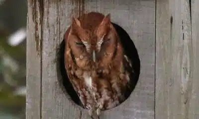
Screech Owls – Small but Cute

NW Arkansas Championship expected to bring money to Rogers

Under pressure, some immigrants are leaving American dreams behind

Huntsville Fire & Rescue Holds 9/11 Memorial Service | Sept. 11, 2025 | News 19 at 5 p.m.

CBS Miami highlights free mammogram program with mobile mammovan

Safe Central Texas meet-up spots for online purchases

Haynes wanted in on Wildlife bribery scheme too, informant says

Mississippi Science Fest showcases STEAM events, activities
15-minute parking spots added in downtown Gulfport to ease congestion during renovations
Statewide literacy meetings aim to boost reading skills and family engagement

Saints Report: Saints lose another close game this time in week two against the San Francisco 49ers

Harrison County approves budget with no tax increase

‘Little quiet light’: Family remembers Delta State University student found dead on campus

The Mustard Seed

WXXV Game of the Week: Week 3

White House officials hold prayer vigil for Charlie Kirk

Jonesboro band culture responsible for global legacy | FOX 5

Family, friends hold candlelight vigil in honor of Giovanni Pelletier
-

 News from the South - North Carolina News Feed6 days ago
What we know about Charlie Kirk shooting suspect, how he was caught
-
 News from the South - North Carolina News Feed6 days ago
Federal hate crime charge sought in Charlotte stabbing | North Carolina
-
Our Mississippi Home5 days ago
Screech Owls – Small but Cute
-
News from the South - Arkansas News Feed6 days ago
NW Arkansas Championship expected to bring money to Rogers
-
News from the South - North Carolina News Feed6 days ago
Under pressure, some immigrants are leaving American dreams behind
-
News from the South - Alabama News Feed7 days ago
Huntsville Fire & Rescue Holds 9/11 Memorial Service | Sept. 11, 2025 | News 19 at 5 p.m.
-
News from the South - Texas News Feed6 days ago
Safe Central Texas meet-up spots for online purchases
-
News from the South - Louisiana News Feed7 days ago
Haynes wanted in on Wildlife bribery scheme too, informant says