News from the South - Alabama News Feed
Alabama's forecast is cooler and wet Thursday, Impact weather Friday for period of rain before a …
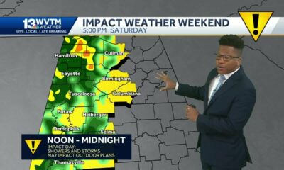
SUMMARY: Central and North Alabama enjoyed a beautiful day with temperatures in the 80s, but changes are on the way. While the afternoon may see increasing clouds with a slight chance of isolated showers, significant rain is forecast for tomorrow, especially on Friday. This period will bring heavy rainfall that could disrupt morning commutes and evening plans, including high school football games. Rainfall totals could reach 1 to 2 inches, primarily south of I-20. Cooler temperatures will be expected as a front moves through over the weekend, leading to more comfortable conditions by Sunday morning.

Alabama’s forecast is cooler and wet Thursday, Impact weather Friday for period of rain before a pleasant weekend
Subscribe to WVTM on YouTube now for more: https://bit.ly/2jvAaUD
Get more Birmingham news: http://www.wvtm13.com
Like us: https://www.facebook.com/WVTM13/
Follow us: https://twitter.com/WVTM13
Instagram: https://www.instagram.com/wvtm13/


News from the South - Alabama News Feed
New Tariffs Could Raise Car Prices | April 2, 2025 | News 19 at 10 p.m.
SUMMARY: A 25% tariff on foreign cars and auto parts is set to take effect at midnight, potentially raising prices for consumers. While current inventory and cars already at U.S. ports will remain at existing prices, future pricing remains uncertain. Dealerships in North Alabama say it’s too early to know the full impact, but warn that repair costs may also rise due to higher parts prices. Some manufacturers may absorb part of the tariff, while others could pass the full cost to buyers—raising a $30,000 car to nearly $40,000. Dealerships report a recent surge in buyers trying to purchase before prices rise.

A 25% tariff on any foreign cars or auto parts will go into effect in a couple of hours.
News 19 is North Alabama’s News Leader! We are the CBS affiliate in North Alabama and the Tennessee Valley since November 28, 1963.
https://whnt.com/
https://www.facebook.com/whntnews19
https://www.instagram.com/whntnews19/
https://twitter.com/whnt
News from the South - Alabama News Feed
Weather Fun 1on1: Brylee explains why thunderstorms occur more often in the summer than in the wi…
SUMMARY: Meteorologist Brylee Brown explains why thunderstorms are more common in summer than winter in her “Weather Fun 1-on-1” segment. Joined by Aidan, they conduct an experiment using two bowls of air at different temperatures. The warm air inflates a balloon, demonstrating that warm air is less dense and rises, while cold air causes the balloon to deflate. This principle helps explain why summer afternoons often bring air mass thunderstorms, as humid, warm air is abundant. In winter, less warm air means these storms are rare. For more weather science resources, viewers can scan a QR code or visit the website.

Weather Fun 1on1: Brylee explains why thunderstorms occur more often in the summer than in the winter
Subscribe to WVTM on YouTube now for more: https://bit.ly/2jvAaUD
Get more Birmingham news: http://www.wvtm13.com
Like us: https://www.facebook.com/WVTM13/
Follow us: https://twitter.com/WVTM13
Instagram: https://www.instagram.com/wvtm13/
News from the South - Alabama News Feed
Religious instruction bill fails House committee; Senate version filed
by Anna Barrett, Alabama Reflector
April 2, 2025
A bill that would require local school boards to adopt policies on extending academic credit for “religious instruction” outside the classroom failed an Alabama House committee on Wednesday.
The House Education Policy Committee rejected HB 342, sponsored by Rep. Susan DuBose, R-Hoover, on a 4-9 vote despite significant amendments to the bill that gave local school boards more flexibility with the policy.
Rep. Terri Collins, R-Decatur, the chair of the committee, said she supported the amendments but said the pushback from both sides was stronger than she expected.
GET THE MORNING HEADLINES.
“I had every superintendent around me actually reach out and ask not to,” Collins said in an interview about her vote. “There was just a lot of passion. The amount of people pushing both ways was extreme, more so than I thought, and that makes me hesitant.”
State law currently allows boards of education to extend that credit, but does not mandate released time religious instruction (RTRI), the subject of DuBose’s bill, in which students can take time out of the school day for religious instruction.
The ministry teaches students about the Christian Standard Bible “with a focus on head, heart and hands,” according to its website. In a sample curriculum, it alters the language and organization of Bible lessons so that children can understand it easily.
Rep. Alan Baker, R-Brewton, also voted against the bill, saying schools can already create religious release time policies. The Legislature passed a law allowing school boards to create a policy in 2019.
“I think the local authorities need to make that decision,” Baker said in an interview. “If they want that there in their system, then they can handle it.”
Collins said she wanted to see more results of the current law.
“My thought is, we passed it several years ago as a ‘may.’ I would like to see how that works a little bit longer,” she said.
Rep. Tashina Morris, D-Montgomery, said the program would take away needed instructional time.
“The school hours haven’t changed, but we keep sticking things into the class time,” she said.
DuBose said the bill may come back next year, but start in the Senate.
“People had a difference of opinion. And that happens all the time,” DuBose said in an interview. “I don’t think anything went wrong.”
SB 278, sponsored by Sen. Shay Shelnutt, R-Trussville, is identical to DuBose’s bill with the amendments. It was filed Tuesday and is in the Senate Education Policy Committee.
YOU MAKE OUR WORK POSSIBLE.
Alabama Reflector is part of States Newsroom, a nonprofit news network supported by grants and a coalition of donors as a 501c(3) public charity. Alabama Reflector maintains editorial independence. Contact Editor Brian Lyman for questions: info@alabamareflector.com.
The post Religious instruction bill fails House committee; Senate version filed appeared first on alabamareflector.com

Measles can ravage the immune system and brain, causing long-term damage – a virologist explains

New Tariffs Could Raise Car Prices | April 2, 2025 | News 19 at 10 p.m.

Miami businesses prepare to absorb costs amid new tariffs

Weather Fun 1on1: Brylee explains why thunderstorms occur more often in the summer than in the wi…
‘Ole Miss basketball isn’t going anywhere’: Rebels stave off attempt by Texas A&M to poach Chris Beard

UMD introduces Buzz Williams as new men’s basketball coach | NBC4 Washington

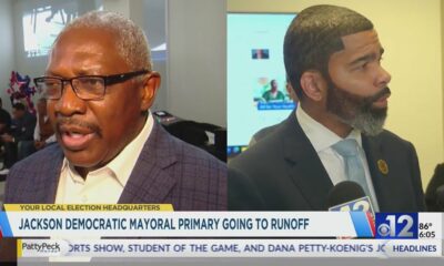
Jackson Democratic mayoral primary heads to runoff

California quashes bill to ban males from female sports, facilities | California

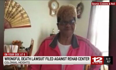
Family files wrongful death lawsuit against Colonial Heights rehab center

Mississippi legislative session to end without lawmakers passing budget

Pharmacy benefit manager reform likely dead

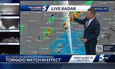
Severe storms will impact Alabama this weekend. Damaging winds, hail, and a tornado threat are al…

University of Alabama student detained by ICE moved to Louisiana

Tornado watch, severe thunderstorm warnings issued for Oklahoma

A little early morning putting at the PGA Tour Superstore

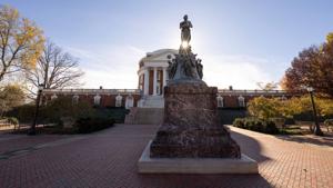
Youngkin removes Ellis, appoints Cuccinelli to UVa board | Virginia

Peanut farmer wants Florida water agency to swap forest land

Hometown Hero | Restaurant owner serves up hope

Georgia road project forcing homeowners out | FOX 5 News

Artificial intelligence experiment begins in North Carolina treasurer’s office | North Carolina
New Tariffs Could Raise Car Prices | April 2, 2025 | News 19 at 10 p.m.
Miami businesses prepare to absorb costs amid new tariffs
Weather Fun 1on1: Brylee explains why thunderstorms occur more often in the summer than in the wi…
UMD introduces Buzz Williams as new men’s basketball coach | NBC4 Washington
Jackson Democratic mayoral primary heads to runoff
Family files wrongful death lawsuit against Colonial Heights rehab center

Trump announces new tariffs | REACTION

Rep. Knox proposes tip tax exemption for Louisiana workers

Deadly shootings at phone repair shop add to concerns for neighbors

Jimmy Patronis’ first speech as Florida Congressman | Full speech
-

 Mississippi Today1 day ago
Pharmacy benefit manager reform likely dead
-
News from the South - Alabama News Feed6 days ago
Severe storms will impact Alabama this weekend. Damaging winds, hail, and a tornado threat are al…
-
 News from the South - Alabama News Feed6 days ago
University of Alabama student detained by ICE moved to Louisiana
-
News from the South - Oklahoma News Feed4 days ago
Tornado watch, severe thunderstorm warnings issued for Oklahoma
-
News from the South - Kentucky News Feed6 days ago
A little early morning putting at the PGA Tour Superstore
-
 News from the South - Virginia News Feed6 days ago
Youngkin removes Ellis, appoints Cuccinelli to UVa board | Virginia
-
News from the South - Florida News Feed7 days ago
Peanut farmer wants Florida water agency to swap forest land
-
News from the South - Georgia News Feed4 days ago
Georgia road project forcing homeowners out | FOX 5 News