News from the South - Alabama News Feed
A Beautiful Weekend on the Gulf Coast, Watching the Tropics: Saturday Morning Forecast 9/21/2024
SUMMARY: Tropical activity is currently low in three areas of the central Atlantic, posing no immediate threat to the US. However, a broad low-pressure system is developing in the Caribbean and southern Gulf, which may become more defined in the coming days. Currently, forecasts indicate potential impacts on the northern Gulf Coast and Florida Keys. Locally, conditions are pleasant with temperatures in the upper 60s to low 70s, expected to rise to the low to mid 90s later today. A dry spell is anticipated, but by mid-week, increased moisture may bring isolated showers and cooler temperatures in the mid to upper 80s.
We start this morning with just a few clouds and temperatures at around 70 degrees. Thanks to high pressure in place, rain chances will stay slim to none across the News 5 area. We will get quite hot this afternoon with highs pushing into the low- to mid-90’s. Rip current risk will remain low throughout the weekend and into the start of next week. With high pressure staying in control through Monday, we will start the fall season with mostly clear skies with high’s in the low-90’s for Sunday and Monday. As southwesterly flow increases aloft into Tuesday and the middle of the week, moisture will increase allowing for more chances for isolated showers and storms. A front will also be to our north and west by Thursday and will pass through the area late Thursday into Friday. The end of next week will also be determined by developments in the tropics. In the tropics we are tracking three areas. Two of them are in the central tropical Atlantic and have a low chance of formation. These do not pose a threat to the News 5 area. Another is in the western Caribbean and in the southern Gulf. The Central American Gyre, a broad area of low pressure, is expected to form a smaller area of low pressure in part of the Caribbean or in the southern Gulf by the middle of next week. It is uncertain where exactly it will develop, how strong it will get, and the exact track. Once it develops, we will have a better idea of where this system will move. For now, make sure you have a tropical plan and stay updated with all the latest here on WKRG.
The WKRG News 5 First Alert Storm Team covers part of southeast Mississippi, southwestern Alabama, and northwest Florida. You can also view the full Saturday morning forecast for the Gulf Coast here: https://tinyurl.com/5dp9smer
Follow Meteorologist Grant Skinner on Facebook: https://www.facebook.com/wkrggrant


News from the South - Alabama News Feed
A very dry September forecast with hot afternoons ahead for Alabama.
SUMMARY: Alabama faces a very dry September with hot afternoons continuing through the last week of summer before the autumnal equinox. Sunday begins comfortably cool in the 60s, warming to low 90s by mid-afternoon under mostly sunny skies. A weak wave may bring a few showers tonight, mainly to northwest Alabama, but widespread rain is unlikely. Temperatures will remain above average, hitting mid-90s Tuesday and Wednesday. By next weekend, a trough and front may increase cloud cover and rain chances slightly, potentially lowering temperatures closer to average. Overall, the forecast calls for persistent dry and warm conditions into next week.
A very dry September forecast with hot afternoons ahead for Alabama.
WVTM13 is your home for Alabama breaking news and weather. For your latest Alabama news and weather visit: https://www.wvtm13.com/
For licensing inquiries: https://www.wvtm13.com/licensing
News from the South - Alabama News Feed
Huntsville Fire & Rescue Holds 9/11 Memorial Service | Sept. 11, 2025 | News 19 at 5 p.m.
SUMMARY: On September 11, 2025, Huntsville Fire & Rescue held a memorial service to honor the nearly 3,000 lives lost in the 9/11 terrorist attacks. Military members and first responders gathered at Huntsville Fire Station One, where at 7:46 a.m., lights, sirens, and air horns sounded to replicate the sounds heard during the attacks. Fire Chief Howard McFarland emphasized the importance of remembering the tragedy to educate younger generations and prevent history from repeating. Former Captain Lynn recalled the shock of witnessing the attacks and noted how 9/11 reshaped emergency preparedness. This annual event is held across all 20 Huntsville fire stations.
The Huntsville Fire & Rescue held a 9/11 memorial service.
News 19 is North Alabama’s News Leader! We are the CBS affiliate in North Alabama and the Tennessee Valley since November 28, 1963.
https://whnt.com/
https://www.facebook.com/whntnews19
https://www.instagram.com/whntnews19/
https://twitter.com/whnt
SUMMARY: On September 11, 2025, News 5 NOW covered 9/11 commemorations, including first responders climbing 2,000 steps at Hancock Whitney Stadium to honor the World Trade Center’s 110 stories. The Original Oyster House offered free meals to first responders in Mobile and Baldwin counties. The program also reported a new Vibrio bacterial infection case in Escambia County, highlighting health warnings for beachgoers. Additionally, they discussed a study linking chronic insomnia to increased dementia risk, election recounts in Gulf Shores, and a recent political shooting in Utah, sparking debate over harsher punishments for political violence. Viewer opinions on extraterrestrials and political violence were shared in an interactive social media segment.
First Responders in Mobile honored the heroes of September 11th, a Pensacola woman is in the hospital after being infected with the flesh eating bacteria vibrio vulnificus, and a vote re-count wrapped up in Gulf Shores…

DNA evidence found near scene of Charlie Kirk’s shooting matches suspect, FBI director says

Jackson State alum Tramell Tillman wins Emmy for ‘Severance’ role

Mobile opioid addiction treatment in Tennessee requires workarounds, for now

Orlando restaurant owner invites artists to parking lot amid federal fight against street art

White House officials hold prayer vigil for Charlie Kirk

Frustrated with poor play against UTEP, Arch Manning will 'get back to basics'

Amazon’s Zoox launches its robotaxi service in Las Vegas

Charlie Kirk murder suspect ‘not cooperating’ with authorities, says Utah governor

Beaufort County warns of rabies and distemper threat to pets, animal officials urge vaccinations

Jonesboro band culture responsible for global legacy | FOX 5

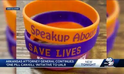
‘One Pill Can Kill’ program aims to reduce opioid drug overdose

Alabama lawmaker revives bill to allow chaplains in public schools

Arkansas’s morning headlines | Sept. 9, 2025

‘Resilience and hope’ in Galveston: 125 years after greatest storm in US history | Texas

Pulaski County town faces scrutiny after fatal overdose

Man tries to save driver in deadly I-85 crash | FOX 5 News

California mother says daughter killed herself after being transitioned by school | California

2025 Mississippi Book Festival announces sponsorship

Group in lawsuit say Franklin county prison land was bought before it was inspected

Lexington man accused of carjacking, firing gun during police chase faces federal firearm charge
White House officials hold prayer vigil for Charlie Kirk
Jonesboro band culture responsible for global legacy | FOX 5

Family, friends hold candlelight vigil in honor of Giovanni Pelletier

Manhunt ends with arrest, new charges for alleged child killer | FOX 5 News

A look at recent flooding across South Florida

Ohio neighborhood fears landslide as retaining wall slips

Summer like temperatures continue

A very dry September forecast with hot afternoons ahead for Alabama.

Possibility of minor flooding in Miami, Fort Lauderdale and Key West due to high tides Sunday

Weather Impact Update for September 13
-

 News from the South - Alabama News Feed6 days ago
Alabama lawmaker revives bill to allow chaplains in public schools
-
News from the South - Arkansas News Feed7 days ago
‘One Pill Can Kill’ program aims to reduce opioid drug overdose
-
News from the South - Arkansas News Feed6 days ago
Arkansas’s morning headlines | Sept. 9, 2025
-
News from the South - Missouri News Feed6 days ago
Pulaski County town faces scrutiny after fatal overdose
-
 News from the South - Texas News Feed6 days ago
‘Resilience and hope’ in Galveston: 125 years after greatest storm in US history | Texas
-
News from the South - Georgia News Feed7 days ago
Man tries to save driver in deadly I-85 crash | FOX 5 News
-
News from the South - Arkansas News Feed6 days ago
Group in lawsuit say Franklin county prison land was bought before it was inspected
-
News from the South - Kentucky News Feed5 days ago
Lexington man accused of carjacking, firing gun during police chase faces federal firearm charge