News from the South - Alabama News Feed
A Beautiful Weekend on the Gulf Coast, Watching the Tropics: Saturday Morning Forecast 9/21/2024
SUMMARY: Tropical activity is currently low in three areas of the central Atlantic, posing no immediate threat to the US. However, a broad low-pressure system is developing in the Caribbean and southern Gulf, which may become more defined in the coming days. Currently, forecasts indicate potential impacts on the northern Gulf Coast and Florida Keys. Locally, conditions are pleasant with temperatures in the upper 60s to low 70s, expected to rise to the low to mid 90s later today. A dry spell is anticipated, but by mid-week, increased moisture may bring isolated showers and cooler temperatures in the mid to upper 80s.
We start this morning with just a few clouds and temperatures at around 70 degrees. Thanks to high pressure in place, rain chances will stay slim to none across the News 5 area. We will get quite hot this afternoon with highs pushing into the low- to mid-90’s. Rip current risk will remain low throughout the weekend and into the start of next week. With high pressure staying in control through Monday, we will start the fall season with mostly clear skies with high’s in the low-90’s for Sunday and Monday. As southwesterly flow increases aloft into Tuesday and the middle of the week, moisture will increase allowing for more chances for isolated showers and storms. A front will also be to our north and west by Thursday and will pass through the area late Thursday into Friday. The end of next week will also be determined by developments in the tropics. In the tropics we are tracking three areas. Two of them are in the central tropical Atlantic and have a low chance of formation. These do not pose a threat to the News 5 area. Another is in the western Caribbean and in the southern Gulf. The Central American Gyre, a broad area of low pressure, is expected to form a smaller area of low pressure in part of the Caribbean or in the southern Gulf by the middle of next week. It is uncertain where exactly it will develop, how strong it will get, and the exact track. Once it develops, we will have a better idea of where this system will move. For now, make sure you have a tropical plan and stay updated with all the latest here on WKRG.
The WKRG News 5 First Alert Storm Team covers part of southeast Mississippi, southwestern Alabama, and northwest Florida. You can also view the full Saturday morning forecast for the Gulf Coast here: https://tinyurl.com/5dp9smer
Follow Meteorologist Grant Skinner on Facebook: https://www.facebook.com/wkrggrant


News from the South - Alabama News Feed
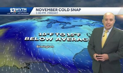
How to Get Your Home Ready for the Winter | Nov. 21, 2024 | News 19 at 6 p.m.
SUMMARY: As temperatures drop in the Tennessee Valley, many are experiencing issues with their heating systems, prompting concerns about burning smells. This is often due to dust buildup, which is typically harmless if it dissipates within 5 to 10 minutes. To avoid heating problems, experts recommend scheduling a system tune-up and ensuring that all entrances have proper weather stripping to prevent heat loss. Regularly replacing air filters also helps maintain the system’s efficiency. For energy savings, the U.S. Department of Energy suggests setting thermostats as low as comfortably possible.
With the drop in temperatures, comes an increase in the number of people cranking up the heat for the first time since last winter.
News 19 is North Alabama’s News Leader! We are the CBS affiliate in North Alabama and the Tennessee Valley since November 28, 1963.
https://whnt.com/
https://www.facebook.com/whntnews19
https://www.instagram.com/whntnews19/
https://twitter.com/whnt
SUMMARY: The holiday season can significantly impact mental health, causing added stress for many. WKRG News 5’s Christina J. Harris speaks with Dr. Lisa Williams from Ivy Leaf Counseling Services, who notes that feelings of loneliness and untreated depression often worsen during this time. To help cope, Dr. Williams suggests grounding techniques, establishing a routine that includes physical activity, and building a support system. She emphasizes the importance of creating a safe space and encourages reaching out for help. Dr. Williams also highlights the availability of the National Crisis Lifeline (988) for those needing support.
The holiday season can be a time to celebrate, but it can also take a toll on a person’s mental health.
FULL STORY: https://trib.al/bF2dFKx
News from the South - Alabama News Feed
New funding from the state helps domestic violence victims in Mobile
SUMMARY: New funding efforts in South Alabama aim to combat domestic violence with a nearly $330,000 grant from the U.S. Department of Health and Human Services. Three organizations, including Penelope House, Lifelines Family Counseling Center, and Baldwin Family Violence Shelter, will utilize this funding to raise awareness and educate the community, particularly schools, about healthy versus unhealthy relationships. In 2023, Mobile recorded over 3,000 domestic violence assaults and eight homicides, highlighting the urgent need for preventative measures. The initiative focuses on teaching young people about relationship boundaries and available resources to support victims.
A grant of nearly $329000 will be going towards prevention of domestic violence, for three local organizations that serve victims in …

Fox 14 Your Morning News: Glicked Movie Weekend

Cocaine-carrying elderly man kills one in hit and run rampage

On this day in 1961

How Trump’s mass deportation plans could impact Florida

Texas lawmaker makes push to remove death penalty in the state | FOX 7 Austin

Meridian native Rodney Hood announces retirement from NBA

Mississippi recorded $21.5 million drop in Q3 gaming revenue

Why did Biltmore remove the beautiful old trees at its main gate? Lead flushing necessary at apartment buildings? City water has a ‘swampy’ smell to it? • Asheville Watchdog

Readers Embrace ‘Going It Alone’ Series on Aging and Chastise Makers of Pulse Oximeters

Georgians With Disabilities Are Still Being Institutionalized, Despite Federal Oversight

Celebrate the holidays in Ocean Springs with free, festive activities for the family

'Hunting for females' | First day of trial in Laken Riley murder reveals evidence not seen yet

First woman installed as commanding officer of NAS Pensacola

A Closely Watched Trial Over Idaho’s Near-Total Abortion Ban Continues Tuesday

On this day in 1972

Trial underway for Sheila Agee, the mother accused in deadly Home Depot shooting

Jose Ibarra found guilty in murder of Laken Riley | FOX 5 News

Alabama's weather forecast is getting colder, and a widespread frost and freeze is likely by the …

Judge grants mistrial in Sheila Agee trial due to ‘unhinged juror’

Habitat Restoration Can Appear Messy
Fox 14 Your Morning News: Glicked Movie Weekend
How Trump’s mass deportation plans could impact Florida
Texas lawmaker makes push to remove death penalty in the state | FOX 7 Austin

Salvation Army partners with local businesses to host Hurricane Victims Benefit Concert in Downto…

Minimal rainfall brings mixed bag

Care Center Ministries helps through Turkey Drive 16

Law enforcement agencies slam Bexar County sheriff’s policy that rejects certain inmates from jail

Documents allege Oklahoma church coverup of man accused of sexually assaulting children

Nearly 1,000 Amazon trucks sent to Humble warehouse in dispatching glitch, police say

Cool morning, Warm afternoon, then a Thanksgiving cold front
-
 Local News6 days ago
Celebrate the holidays in Ocean Springs with free, festive activities for the family
-
 News from the South - Georgia News Feed7 days ago
'Hunting for females' | First day of trial in Laken Riley murder reveals evidence not seen yet
-
 News from the South - Alabama News Feed7 days ago
First woman installed as commanding officer of NAS Pensacola
-
 Kaiser Health News4 days ago
A Closely Watched Trial Over Idaho’s Near-Total Abortion Ban Continues Tuesday
-
 Mississippi Today6 days ago
On this day in 1972
-
 News from the South - Alabama News Feed3 days ago
Trial underway for Sheila Agee, the mother accused in deadly Home Depot shooting
-
 News from the South - Georgia News Feed2 days ago
Jose Ibarra found guilty in murder of Laken Riley | FOX 5 News
-
 News from the South - Alabama News Feed3 days ago
Alabama's weather forecast is getting colder, and a widespread frost and freeze is likely by the …