News from the South - Louisiana News Feed
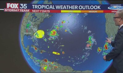
Friday 5 am Tropical Update: Invest 90 fuel tropical rains in the Gulf
SUMMARY: Coastal areas may experience minor flooding on low-lying roads, but conditions should improve by early next week. Although water levels may remain elevated over the weekend, moisture is expected to move southward and then shift northwest before being drawn back northward next week. This could lead to increased rain chances, particularly heavy rainfall expected today and into tomorrow morning. Sunday appears to be a nicer day, while next week brings a forecast of scattered storms. Overall, monitoring of moisture patterns and potential rain events will be crucial in the coming days.
The NHC is watching a tropical wave in the Caribbean Sea. It has a low chance of becoming a depression in the next few days as it moves into the western Caribbean.
The NHC is also watching a tropical wave in the Caribbean Sea. It has a low chance of becoming a depression the next few days as it moves into the western Caribbean and extreme southern Gulf.
News from the South - Louisiana News Feed
Warmer days but a little less humid, and tracking the tropics closely
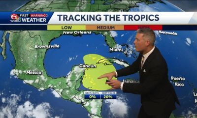
SUMMARY: Today‘s weather features some fading showers tracked by WDSU’s Doppler radar, primarily in the River Parishes and near marshy areas. Rain chances are decreasing as a warm front approaches, with temperatures expected to reach up to 91°F this week. Tomorrow may see isolated showers, but overall conditions will improve with lower humidity heading into the weekend. Attention shifts to possible tropical development in the Yucatán Straits, with only a 20% chance of formation. Current forecasts suggest potential impacts may steer any system away from our region towards Florida or Mexico, but updates will continue.
Meteorologist Devon Lucie shows us the isolated showers that were out Wednesday evening, then steps us through the next couple of days letting you know where rain chances will go and how that will affect temperatures and what the humidity levels will do through the weekend, then takes a closer look at the extended forecast that’s connected to what might happen in the Western Caribbean and the Gulf of Mexico next week, while finally focusing on the tropics with the low chance of possible development in the Western Caribbean the the Yucatan Channel and what type and strength of storm activity we’re tracking and what will drive the path of what will steer the system that will determine the impact it will have on Louisiana, then finally taking a look at the entire seven day forecast with high temperatures and rain chances through next Wednesday.
Subscribe to WDSU on YouTube now for more: http://bit.ly/1n00vnY
Get more New Orleans news: http://www.wdsu.com
Like us: http://www.facebook.com/wdsutv
Follow us: http://twitter.com/wdsu
Instagram: https://www.instagram.com/wdsu6/
News from the South - Louisiana News Feed
Beware of contractor fraud after Hurricane Francine
SUMMARY: Kenner Police are warning residents about a new scam targeting Hurricane Francine victims, involving contractor fraud. They have received reports and provided tips online to help prevent such scams. Key recommendations include obtaining the contractor’s name, business address, and license number before hiring. It’s crucial to verify their credentials with the state‘s licensing board, require proof of active insurance, and have a written contract signed by both parties. Additionally, consumers should avoid making large upfront payments and never pay for work that hasn’t been completed.
Beware of contractor fraud after Hurricane Francine
Subscribe to WDSU on YouTube now for more: http://bit.ly/1n00vnY
Get more New Orleans news: http://www.wdsu.com
Like us: http://www.facebook.com/wdsutv
Follow us: http://twitter.com/wdsu
Instagram: https://www.instagram.com/wdsu6/
News from the South - Louisiana News Feed
Only the most minor of relief from heat as we head into the weekend
SUMMARY: This week, San Antonio is experiencing extreme heat, reaching 96°F, making it one of the hottest locations in the U.S. The high humidity exacerbates the heat, and a ridge of high pressure will persist. A low-pressure system from the Four Corners may slightly shift the heat by Sunday, leading to a minor temperature drop. However, temperatures will still be in the upper 90s with heat index values surpassing 100°F by Sunday, coinciding with the Equinox at 7:44 AM. While there may be a slight change in temperature, significant relief from the heat is not expected.
Only the most minor of relief from heat as we head into the weekend. DETAILS: https://www.ksat.com/weather/2024/09/18/happy-wednesday-theres-a-bit-of-good-news-in-the-extended-forecast/
-
Mississippi News Video5 days ago
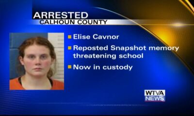
Woman arrested after reposting school threat in Calhoun County
-
News from the South - Louisiana News Feed5 days ago
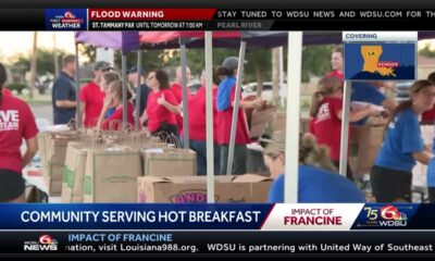
Food drive underway for Hurricane Francine victims in Kenner
-
Mississippi Today2 days ago
On this day in 1925
-
News from the South - Kentucky News Feed4 days ago
The search for Joseph Couch intensifies
-
News from the South - Alabama News Feed2 days ago
Diddy Arrested In Manhattan | September 16, 2024 | News 19 at 10 p.m.
-
News from the South - Alabama News Feed5 days ago
Sylacauga Church welcomes Haitian migrants amid speculations
-
Mississippi Today3 days ago
Another Midwest drought is causing transportation headaches on the Mississippi River
-
News from the South - Florida News Feed6 days ago
Tropics update: Tropical Depression 7, 2 other disturbances brewing in Atlantic


